 |
|
|
|
|
|
|
|
|
|
|
|
|
|
|
|
|
|
|
|
|
|
|
|
|
|
|
|
|
|
|
|
|
|
|
|
|
|
|
|
|
|
|
|
|
|
|
|
|
|
|
|
|
|
|
|
|
|
|
|
|
|
|
|
|
|
|
|
|
|
|
 |
|
|
|
|
 |
|
 |
|
|
|
|
|
|
|
|
|
|
|
|
|
|
|
|
 |
|
|
|
|
|
|
|
|
|
|
|
|
|
|
|
 |
|
|
|
|
|
|
|
|
|
|
|
This 2007 photo shows the eastbound Ocean Parkway in Oak Beach. The parkway continues east to the Robert Moses Causeway and Captree State Park. (Photo by Steve Anderson.)
|
|
|
|
|
|
|
|
|
 |
|
|
|
|
 |
|
|
|
|
|
|
|
|
Length:
Constructed:
NYSDOT Reference Route:
|
|
|
|
|
|
|
|
|
15.6 miles (25.1 kilometers)
1930-1934
NY 908H
|
|
|
|
|
|
|
|
|
|
|
|
|
|
 |
|
|
|
|
|
THE PARKWAY BY THE SEA: Constructed in the early 1930's to serve Jones Beach State Park and other barrier beaches, the Ocean Parkway is seen by many as the crown jewel of the Long Island parkway system. A drive on the parkway, which has maintained much of its original design characteristics, reveals sweeping vistas of the Long Island mainland, Great South Bay and the Atlantic Ocean.
|
|
|
|
|
|
|
|
|
|
|
|
|
|
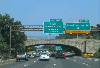
The Ocean Parkway begins at Jones Beach State Park, where the Meadowbrook State Parkway meets the Bay Parkway. Approximately one mile to the east, the Ocean Parkway meets the Wantagh State Parkway at the Water Tower traffic circle. For the next 13 miles, the Ocean Parkway traverses beachfront communities, local beaches and Gilgo State Park. The parkway intersects the Robert Moses Causeway at a cloverleaf interchange before terminating at Captree State Park.
DESIGN AND CONSTRUCTION: The parkway was constructed with two 24-foot-wide roadways providing two lanes in each direction. A third lane is provided in the eastbound direction from the Meadowbrook State Parkway in Nassau County east to Gilgo State Park in Suffolk County. The two roadways are separated by a variable median covered with beach grass. Exit ramps and median U-turn lanes provide access to Tobay Beach, Gilgo Beach and Oak Beach. Underpasses provide beach access from parking lots and barrier beach communities. Two additional pedestrian underpasses along the parkway were provided for never-built parking fields east of the existing Jones Beach State Park.
Because of its barrier island location, the Ocean Parkway itself is subject to frequent closures in the winter months. Fragile beach dunes, some only five feet high, separate the parkway from the beach and the Atlantic Ocean. Over the years, many of the characteristic timber lightposts that once adorned the Ocean Parkway have been lost to winter storms. However, a few hearty leftover lightposts remain standing.
|
|
|
|
|
|
|
|
|
|
|
|
|
|
|
|
|
In 2013, the NYSDOT completed a $32 million to rebuild a 4.8-mile-long eastbound section of the Ocean Parkway near the Nassau-Suffolk border that had washed away after Hurricane Sandy in October 2012. The parkway was closed completely for a month after the hurricane as engineers inspected the damage. A month later, traffic was diverted onto the undamaged westbound lanes between Cedar Beach and Tobay Beach. During the reconstruction period, which restricted traffic to one lane in each direction, the speed limit was reduced to 35 MPH. The parkway was completely reopened to traffic in both directions the following April.
|
|
|
|
|
|
|
|
|
|
|
|
|
|
|
|
|
|
|
|
|
|
|
|
|
According to the New York State Department of Transportation (NYSDOT), the Ocean Parkway handles approximately 15,000 vehicles per day (AADT). Since it lies south of Merrick Road and Montauk Highway (NY 27A) for its entire length, the parkway can legally accommodate commercial vehicles.
RESTORING A LANDMARK PARKWAY: The entire length of the Ocean Parkway is designated as a "Robert Moses National Register Parkway." Many facets of the original parkway design, including the guardrails and landscaping, are protected. More on the timber lightposts from NYSDOT spokeswoman Karen Taylor as follows:
The NYSDOT had a project to improve the highway lighting on all parkways south of the Southern State Parkway, including Ocean Parkway. These scenic parkways are considered historic by the State Historic Preservation Office, and therefore required the NYSDOT to develop special, safe and decorative lightpoles that maintain the historic character of the areas. Since these special poles are much more expensive than regular lightpoles, the NYSDOT had to scale back the project and restrict the lighting project area to the more heavily traveled Meadowbrook State Parkway and Loop Parkway. As funding permits, lighting on other portions of this historic parkway will be upgraded in future contracts.
In the mid-2010s, several replica lightpoles were installed at the interchange of the Ocean Parkway and Robert Moses Causeway, but nothing beyond this installation was ever completed.
|
|
|
|
|
|
|
|
|
|
|
|
The NYSDOT also is planning a 14-mile-long bikeway along the westbound lanes of the Ocean Parkway. Construction of the $14 million bikeway, which will eventually connect to the Long Island mainland via bikeways along the Wantagh State Parkway and the Robert Moses Causeway, is slated for completion by mid-decade. Facilities along the parkway will include bicycle parking, rest areas, water, telephones and other amenities.
|
|
|
|
|
|
|
 |
|
|
|
|
|
|
|
|
|
|
|
|
|
|
 |
|
|
|
|
|
|
|
|
|
|
|
This 2015 photo shows the eastbound Ocean Parkway at the Jones Beach Water Tower traffic circle, where the Ocean Parkway meets the Wantagh State Parkway. (Photo by David Golub, www.eastcoastroads.com.)
|
|
|
|
|
|
|
|
|
 |
|
|
|
 |
|
|
|
 |
|
|
|
|
|
PLANS TO REBUILD AFTER THE GREAT 1938 HURRICANE: On October 26, 1938, Robert Moses presented plans for 47.5 miles of new parkway on Fire Island as part of a comprehensive plan to restore and build upon the barrier beach. The plan was announced one month after the "Long Island Express," a Category 3 hurricane that buffeted Long Island with sustained winds of 120 miles per hour and storm surges of 15 feet.
|
|
|
|
|
|
|
|
|
|
|
|
|
|
The characteristics of the $9.3 million "Moses-Andrews" plan were as follows:
Approximately 35 million cubic yards of sand fill was to have been pumped onto Fire Island. The sand fill was to form a continuous embankment 14.5 feet high from Fire Island Inlet to the Shinnecock Coast Guard station. The sand fill was to be level for a width of approximately 80 feet, and then slope away at the rate of 1:30. Additional sand was to be used to fill in the unstable Moriches Inlet and Shinnecock Inlet, both of which were created during a 1931 storm and widened during the 1938 hurricane.
A new intracoastal boat channel 200 feet wide and 15 feet deep was to be dredged through Great South Bay, Moriches Bay and Shinnecock Bay. The sand that was dredged in this operation was to be used for shoring up Fire Island.
A two-lane, 22-foot-wide concrete parkway, flanked by nine-foot-wide turf shoulders, was to be constructed atop the level portion of the sand fill. The undivided parkway, which was to allow one travel lane in each direction, was to have full control of access at interchanges. Both the concrete pavement and turf shoulders were designed to control erosion.
New parkway spurs and bascule lift bridges were to be constructed to the Long Island mainland along the present-day William Floyd Parkway (Suffolk CR 46) and Ponquogue Avenue (Suffolk CR 32). Both spurs were to terminate at Montauk Highway (NY 27A-Suffolk CR 80).
New state parks were to be developed at Point O'Woods, Smith Point and Quogue, and the existing Fire Island (Robert Moses) State Park was to be reconstructed.
The route of the proposed Ocean Parkway Extension lay directly in the route of a number of Fire Island communities accessible only by ferry. Its construction would have meant the condemnation of hundreds of homes, most occupied by summer residents, with the rest maintained by year-round residents. Fears of lower property valuation and the loss of isolation on Fire Island, as well as concerns over the high cost of the proposed project, prompted the Suffolk County Board of Supervisors to vote seven to three against the Moses plan. Instead, county officials approved a less ambitious $1.5 million plan to preserve the Fire Island dunes.
|
|
|
|
|
|
|
|
|
 |
|
|
|
|
|
 |
|
|
|
|
|
|
|
|
This 2018 photo shows the westbound Ocean Parkway just west of the Robert Moses Causeway in Oak Beach. Only a few replica lightpoles were installed at this interchange in a mid-2010s demonstration project. (Photo by Steve Anderson.)
|
|
|
|
|
|
|
|
|
|
|
|
|
|
|
|
|
|
|
|
|
|
|
|
|
|
|
|
|
|
MOSES' SECOND PARKWAY ATTEMPT: In 1962, a 15-member temporary state commission approved a $102 million package to protect the 137-mile Atlantic shoreline from Staten Island to Montauk. Once again, the centerpiece of this package was the proposed extension of the Ocean Parkway. However, this proposal truncated the length of the parkway to 25 miles, with the eastern terminus at Smith Point County Park. The eastern seven miles of Fire Island to Moriches Inlet was to be set aside for a natural reserve.
|
|
|
|
|
|
|
|
|
|
|
|
|
|
To mitigate community concerns, Moses planned for controlled access to Fire Island points. However, to make way for the parkway, some 2,200 homes in a dozen communities, most of them occupied by summer residents, were to have been either moved or torn down. As in past battles, Moses was made the object of contempt.
In light of the behavior of the protestors at the first public hearing in July 1962, The Bay Shore Sentinel-Journal wrote the following editorial in favor of Moses:
Mr. Moses is a fairly thick-skinned individual; otherwise he would not have accomplished the things that one day, collectively, will be a monument to his years in public service. A public official doing his job in the interests of all, and who is convinced he is doing the right thing - in this case a parkway-topped sand dune along 25 miles of Fire Island Beach - is bound to come under criticism
The beach road issue is controversial. Tempers were bound to flare. But it was not a time to engage in personalities. (Moses) walked out and it was good to note that the commission on which he sat was not intimidated by the ill-mannered attendance gloating over the invective heaped upon him by a speaker who compared him to Hitler. The part-time beach dwellers hurt their cause. They proved themselves to be motivated by selfish interest
A generation ago, when the Ocean Parkway from Jones Beach to Captree was projected, there also was controversy. Then, Moses dealt with public lands. The road was built. It probably saved Oak Beach, Cedar Beach, Gilgo Beach and Jones Beach from breaking up. Today, Moses is dealing with beachland under private ownership. This accounts for the passion engendered, but it doesn't change the overall objective: protection and preservation of the beach and of the mainland, for with the beach removed, the South Shore would be subject to assault by the sea
In the end, the people who heaped invective upon him will come to realize that they aren't being dealt short.
Over the next two years, however, these residents received public support from politicians and environmentalists. Together, they formed an alliance to save the dunes, beach grass and the rare Sunken Forest. In 1964, Congressman Otis Pike (D-Suffolk County) introduced legislation to create the Fire Island National Seashore. This designation, combined with recently enacted legislation severely restricting highway construction through parkland, effectively killed the Ocean Parkway Extension.
John A. Black, professor of biology at Suffolk County Community College, opposed the conventional wisdom that the parkway would cause environmental damage. In the following 1988 excerpt, he argued that the Ocean Parkway helped preserve Jones Beach, and that construction of the Ocean Parkway Extension would have gone a long way to save Fire Island and Westhampton Beach:
Robert Moses, instead of building an ordinary road lined with all kinds of objectionable shacks and signs, planned to build a parkway with very infrequent access. Limited access proved to be the major reason that the dunes and bayside salt marshes along Jones Beach have been preserved, and that random development has not occurred. One need only compare the aesthetic drive along this barrier beach to the one along the Rockaways, Long Beach or Westhampton Beach to see the protection afforded by a limited access parkway. Even along road-less Fire Island, the unrestricted use of off-the-road vehicles has wrought greater havoc to the dunes and beach, and has opened this island to more random development than the millions of autos that traverse the Ocean Parkway on Jones Beach.
The extension of the Ocean Parkway was opposed, initially in the 1930s on economic grounds and then, in the 1960s, by the environmental movement. Had Moses been successful, a limited access parkway would have prevented the over-development, mismanagement and virtual destruction of Westhampton Beach. It also would have prevented the random development on all of Fire Island, and the destruction of the dunes on the eastern portion of that island due to the unregulated use of off-the-road vehicles at Smith Point County Park.
The "roadways to nowhere" to what would have been Ocean Parkway Extension are found at the U-turn after Field 5 at Robert Moses State Park. These "roadways to nowhere" also are found at the western end of Fire Island Beach Road (Suffolk CR 75) at Smith Point County Park.
|
|
|
|
|
|
|
|
|
|
|
|
|
|
 |
|
|
|
|
|
This 1938 photo shows the Ocean Parkway along the barrier beach between Jones Beach State Park and Captree State Park. Underpasses connect communities north of the parkway with ocean beaches. (Photo by Long Island State Park Commission, supplied by Russ Weisenbacher.)
|
|
|
|
|
|
|
|
|
|
|
|
|
|
|
|
 |
|
|
|
|
|
FROM ROBERT MOSES PARK TO SMITH POINT PARK: The Ocean Parkway Extension should be considered for future construction between Robert Moses State Park and Smith Point County Park. The eastern end of the parkway would use the existing segment of Fire Island Beach Road (Suffolk CR 75), a four-lane divided highway serving Smith Point County Park. Access to the Ocean Parkway Extension would be provided at the western and eastern termini: the Robert Moses Causeway and the William Floyd Parkway (Suffolk CR 46). To facilitate construction of the parkway extension, no new residential or commercial development would be permitted on Fire Island. Provisions would be made for a potential span over Old Inlet just west of Smith Point Park, if officials decide the keep the breach caused by Hurricane Sandy permanent. This plan should be studied in conjunction with Federal and state authorities to determine its viability.
|
|
|
|
|
|
|
|
|
|
|
|
|
|
|
|
|
|
|
|
|
|
|
|
|
|
 |
|
|
|
|
|
SOURCES: "Beaches Rising Again Where Storm Passed," New York Herald-Tribune (12/27/1938); "Restoration and Protection of Fire Island," Long Island State Park Commission (1938); "State Unit Votes Shorefront Plan" by McClandish Phillips, The New York Times (7/28/1962); Public Works: A Dangerous Trade by Robert Moses, McGraw-Hill (1970); The Power Broker by Robert A. Caro, Vintage Books-Random House (1974); History of the Long Island State Parkway System, New York State Department of Transportation (1985); "Reassessing Robert Moses: The Legacy of a Power Broker," The Newsday Magazine (12/04/1988); Robert Moses: Single-Minded Genius by Joann P. Krieg, Heart of the Lakes Publishing (1989); "The Long Island Express: The Great Hurricane of 1938" by Scott A. Mandia, Suffolk County Community College (1998); "Ask Dr. Conehead" by Kim Nava-Fiorio, Newsday (2/06/2000); "Critics: DOT's Bike Plan Doesn't Go Far Enough" by John Valenti, Newsday (3/31/2002); "Ask Dr. Conehead" by Kim Nava-Fiorio, Newsday (3/23/2003); "Ask Dr. Conehead" by Kim Nava-Fiorio, Newsday (12/21/2003); "Long Island's Ocean Parkway Reopens Monday," WNBC-TV (11/25/2012); "Ocean Parkway Fully Reopens After Superstorm Sandy," WABC-TV (4/25/2013); New York Metropolitan Transportation Council; Dave Block; Daniel T. Dey; Ralph Herman; Nathan W. Perry; Jeff Saltzman; Russ Weisenbacher.
Ocean Parkway shield by Ralph Herman.
Lightposts by Jeff Saltzman.
Bike route sign by Richard C. Moeur.
|
|
|
|
|
|
|
|
|
|
|
|
|
|
|
|
 |
|
|
|
|
|
|
|
|
|
|
|
|
|
|
|
|
|
|
 |
|
|
|
|
|
|
|
|
 |
|
|
|
|
|
|
|
|
 |
|
|
|
|
|
|
|
|
|
|
|
|
Site contents © by Eastern Roads. This is not an official site run by a government agency. Recommendations provided on this site are strictly those of the author and contributors, not of any government or corporate entity.
|
|
|
|
|
|
|
|
|
|