
|
NEW YORK 1928: Find out what the New York area looked like in 1928, at the onset of the US highway system and the beginning of the parkway building era. |
||
|
NEW YORK 1941: Find out what the New York area looked like in 1941. Included in this section are eight Gousha maps showing the development of the New York-area parkway system. |
||
|
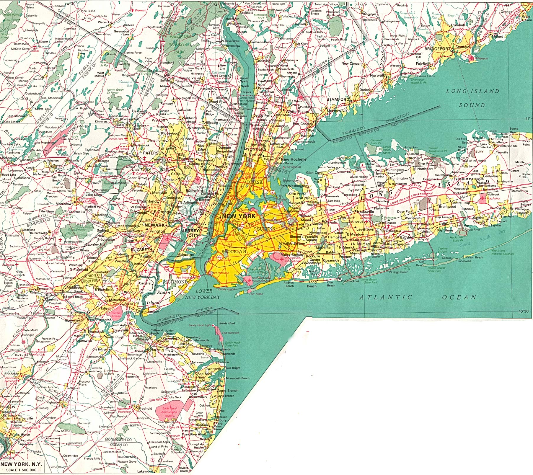
NEW YORK 1960: Find out what the New York area looked like in 1960. Included in this section are four Rand McNally maps containing roads showing the beginnings of the Interstate highway system in the New York metropolitan area. |
||
|
NEW YORK 1970: This map from the University of Texas Library archives shows the New York-New Jersey-Connecticut arterial system near completion. Nevertheless, important gaps remain (such as I-287), I-78 is still proposed through New York City, and I-95 is still proposed through central New Jersey. |
||
|
Before Robert Moses built his network of arterial highways, there was the Long Island (Vanderbilt) Motor Parkway. This page explores the history of America's first limited-access highway. |
||
|
Although Robert Moses was unable to part the waters, he proved capable of crossing them. For without him, "The Roads" and "The Crossings" would not have been possible. Newsday, The Atlantic Monthly and the New York City Parks Department provide some interesting insights into the man who shaped the face of 20th century New York. |
||
|
Jeff Saltzman's "Streetlight Site" and Kevin Walsh's "Forgotten New York" contains information on street and highway lighting fixtures used in the New York metropolitan area, as well as photos of highway scenes. |
||
|
The Long Island Parkway System: An Overview. This was compiled by the New York State Department of Transportation and The Museums at Stony Brook. For those seeking more background information on the parkway system, this is an excellent primer. |
||
|
The 1947-1948 toll schedule for bridges, tunnels and ferries in New York State comes from the Official Map and Guide to New York State. It was scanned by Matt Steffora. |
||
|
The Joint Study of Arterial Facilities: An Overview. In 1955, the Triborough Bridge and Tunnel Authority and the The Port of New York Authority developed recommendations for new bridges and expressways in the New York City area. The foreward to the study was written by Robert Moses. |
||
|
In the May 1964 edition of Regional Plan Association News, the Regional Plan Association and the Tri-State Transportation Commission provided an insightful, far-sighted approach to expressway planning. |
||
|
In 1971, the New York State Department of Transportation commissioned Creighton, Hamburg, Incorporated to conduct a comprehensive study on proposed crossings of Long Island Sound. |
||
|
What were the speed limits on New York metro area highways before the enactment of the National Mandatory Speed Limit (NMSL) in 1974? |
||
|
During the 1990's, transportation and planning officials attempted to address the issue chronic congestion of road and rail facilities in the New York metropolitan area. |
||
|
INTERSTATE HIGHWAY SYSTEM -- FACTS AND HISTORY: |
||


|
|
||
|
|
||
|
|
||