The following summary and recommendation is from a study prepared by Creighton, Hamburg, Incorporated for the New York State Department of Transportation in December 1971. The full contents of this study can be found at the Arthur Kunz Memorial Library, Suffolk County Planning Department in Hauppauge, New York.

INTRODUCTION


Since 1965, a number of separate engineering and traffic studies have been made of potential bridge crossings of Long Island Sound. In 1970, funds were authorized by the Legislature of the State of New York to undertake a study to deal comprehensively with all aspects of Sound crossings. On December 21, 1970, the New York State Department of Transportation entered into an agreement (Contract D-48849) with the firm Creighton, Hamburg, Incorporated for the conduct of this study.

The purpose of the study was to determine, for the region encompassing Long Island Sound, the need for, and impact of, alternative bridge crossings of the Sound. Recommendations for bridge crossings, if any, were to be at the "corridor" level of detail - that is, recommendation general locations, rather than precise right-of-way lines.

Technical assignments were distributed among eight different organizations. Each of these assignments dealt with a single topic. Evaluation of the separate consultant reports and coordination of their findings into a single viewpoint was undertaken by Creighton, Hamburg, Incorporated. The following subject areas were investigated as follows:

REGIONAL CONSIDERATIONS:
TRANSPORTATION OPERATIONS:
FINANCIAL CONSIDERATIONS:
ECONOMIC STUDIES:
NATURAL ENVIRONMENT:
NOISE:
AIR POLLUTION:
COMMUNITY IMPACT:
VISUAL IMPACT:
RECREATIONAL BOATING:

Creighton, Hamburg, Inc.
Merrill Lynch, Pierce, Fenner and Smith, Inc.
Economic Consultants Organization, Inc.
Marine Sciences Research Center (SUNY)
Bolt Beranek and Newman, Inc.
Environment/One Corporation
The Planning Services Group, Inc.
Carl Feiss, FAIA, AIP and Robert N. Anderson, AIA
Creighton, Hamburg, Inc.

The emphasis of these studies was on measurement. This provided objective means for comparing impacts between different bridges, and for placing the various impacts of bridge construction in proper perspective within the entire region.

The region dealt with in this study is composed of the Tri-State Region as defined by the Tri-State Regional Planning Commission, together with counties in Connecticut that border Long Island Sound.

Eight alternative bridge crossing sites were given to the consultant for study by the New York State Department of Transportation. They were as follows (shown west to east):

  1. Sands Point, NY-New Rochelle, NY
  2. Glen Cove, NY-Rye, NY
  3. Oyster Bay, NY-Rye, NY
  4. Port Jefferson, NY-Bridgeport, CT
  5. Shoreham, NY-New Haven, CT
  6. Riverhead, NY-Guilford, CT
  7. East Marion, NY-Old Saybrook, CT
  8. Orient Point, NY-Watch Hill, RI

(Another alternative bridge location, between Northport, New York and Norwalk, Connecticut, which had been included in earlier studies, was dropped from considerations.)

REGIONAL CONSIDERATIONS


The force that lies behind demand for transportation improvements is the growth of population and the economy. The population of the New York region, including Connecticut counties bordering Long Island Sound, is expected to grow from 19.1 million people in 1970 to 26.1 million people in the year 2000.

Regional and local plans and forecasts show this enlarged population spreading ever outwards. The population of Westchester is expected to rise from 887,000 in 1970 to 1,313,000 in the year 2000. The population of Nassau-Suffolk is expected to rise from 2,534,000 in 1970 to 4,157,000 in the year 2000. The population of the four Connecticut counties bordering Long Island Sound is expected to rise from 1,854,000 in 1970 to 2,877,000 in the year 2000.

Population growth, economic growth, and the spreading outward of the metropolis are independent forces over which government has very little control at the regional level. The projected growth amounts and the pattern of land development are expected to occur whether or not a bridge is built.

From a technological viewpoint, Long Island can contain 9.5 million to 10 million people. Whether this is desirable or not from a human and social viewpoint cannot be answered adequately at this time. It appears certain, however, that without a crisis such as water supply, the "rules" under which we operate as a society are incapable of setting a limit to the population of Long Island. It is also certain that a bridge decision (to build or not to build) is irrelevant as a factor in controlling Long Island's growth, since the island is already a metropolis within its own right.

The movement of population further out on Long Island increases the separation of that population from the rest of the metropolitan area. Driving between Nassau-Suffolk (which has a population greater than that of the Pittsburgh metropolitan area) and Westchester, New England, Upstate New York and points west is only accomplished by going into New York City and out again. As population grows, people will be required, as they travel to the bridges at the western end of Long Island, to pass through a territory of congestion that will be made worse by the growing population itself. This is significant not only for the transportation of people, but also for the movement of goods.

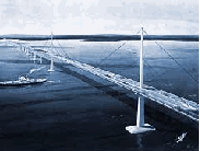
At present, about 33 million trips are made annually to and from Nassau-Suffolk across the Throgs Neck, Bronx-Whitestone and Triborough bridges. These bridges are now nearing their capacity limits. If a new bridge is not built, traffic congestion on these bridges and on radial expressways will increase. The costs of goods movements will likely increase as a result. Finally, the people on the island will become steadily more isolated.

TRANSPORTATION OPERATIONS


Estimates were prepared of traffic volumes that would use each of the eight alternative bridge crossings for the years 1975 to 2000. Crossings range from 45,800 daily on the Sands Point-New Rochelle Bridge to 6,800 daily on the Orient Point-Watch Hill Bridge, both at base tolls. The three western bridge locations have much higher estimated traffic volumes due to their higher densities of population and, in part, to their lower toll structure.

Studies were made to determine optimum tolls, which maximize gross revenue. Generally, optimum tolls are higher than base tolls. They ranged from $1.50 at the Sands Point-New Rochelle Bridge to $4.00 to the two eastern bridge locations.

Secondary transportation impacts include changes in traffic on existing bridges and expressways. The Bronx-Whitestone and Throgs Neck Bridges, now at approximately 93 percent of their peak hour design capacity and expected to reach 100 percent of design capacity by 1975, would be relieved by building a new bridge.

The construction of any new bridge across Long Island Sound will relieve such facilities as the New England Thruway (I-95), Major Deegan Expressway (I-87), Long Island Expressway (I-495), and Cross Island Parkway. Typical is the effect of the Oyster Bay-Rye Bridge: it would reduce daily traffic on the Long Island Expressway west of Glen Cove Road (EXIT 39) by approximately 5,000 vehicles per day.

The construction of any new bridge across Long Island Sound will reduce the vehicle miles of travel now driven on eleven major expressway corridors in the region, with attendant reduction in air pollution. The Glen Cove-Rye Bridge provides the greatest reduction in air pollution, followed closely by the Oyster Bay-Rye Bridge.

The construction of either the Glen Cove-Rye Bridge or the Oyster Bay-Rye Bridge would increase traffic on the Cross Westchester Expressway (I-287). This is the only major facility, however, that is adversely affected to any significant degree. The eastern part of the Cross Westchester Expressway, currently carrying 32,000 vehicles per day near I-95, and with a design capacity of 54,000 vehicles per day, would have 10,500 daily vehicles added to its existing load in 1975 by the Glen Cove-Rye Bridge, and slightly less by the Oyster Bay-Rye Bridge. This can be readily carried out until at least 1980, and longer at optimum tolls. Improvements in the Cross Westchester Expressway should be programmed concurrent with bridge construction, however.

The opportunity for using the construction of one or more bridges across Long Island Sound to improve mass transportation operations was examined. Except for a limited amount of bus transportation that might be generated, no significant opportunity exists for improving mass transportation.

FINANCIAL CONSIDERATIONS


The financial consultant was furnished with estimates of net revenues for eight bridges from the year of opening to the year 2002, together with toll rates, estimates of construction costs, and the estimated lengths of construction time. The financial consultant then made certain assumptions uniformly applied to all bridges, including 40-year term bonds, a capitalized debt service equal to the maximum annual debt service requirement, and the payment of interest from bond proceeds over the construction period plus a one-year start-up period thereafter.

Since interest rates can vary significantly with the passage of time, and since the date when the bonds will be sold is not known, the principal amounts of the bond issues and the annual debt service requirements were calculated at three different interest rates: 5%, 6% and 7%.

Net revenues were then compared with debt service requirements for all eight bridges at three different interest rates. The financial consultant concluded that the three western bridge alternatives had positive coverage ratios, in all years after opening:

While the estimates on which these coverage ratios are based, particularly the estimates of construction costs, are not well fixed enough at this time to permit a firm determination of financial feasibility, the coverage ratios seem sufficiently promising at this point in time for the Sands Point-New Rochelle, Glen Cove-Rye, Oyster Bay-Rye bridges to warrant more detailed investigations. If a decision is made to go ahead with the construction of any of these three bridges, we would strongly urge the provision of some form of additional security beyond revenues alone, since such additional security can mean a smaller total bond issue, a lower interest rate, possibly lower tolls, and a better reception of bonds by the investing public.

ECONOMIC STUDIES


Estimates of future population of the New York metropolitan region, for the years 1970 to 2000, were prepared by the economic consultant. Gains in employment, labor force, sales by major industry, and fully taxable valuation of property were also estimated.

Order of magnitude estimates of the impact of Long Island Sound bridges on the economic growth rates of adjacent counties were made. For this purpose, the region was divided into three corridors, since the impacts of individual bridges could not be distinguished from one another with precision. The western corridor would be served by the Sands Point-New Rochelle, Glen Cove or Oyster Bay-Rye bridges; the central corridor by the Port Jefferson-Bridgeport, Shoreham-New Haven or Riverhead-Guilford bridges; the eastern corridor by the East Marion-Old Saybrook or Orient Point-Watch Hill bridges.

By 1980, any one of the three western bridges is expected to generate 22,000 additional jobs on both sides of the Sound; any one of the three central bridges 6,300 additional jobs; and any one of the two eastern bridges 5,700 additional jobs. The economic consultant indicates that the presence of a bridge would have a favorable impact on the economies of counties in the vicinities of the bridgeheads in succeeding decades after 1980, but to a lesser extent.

NATURAL ENVIRONMENT


Studies of potential impact of trans-Sound bridges on the natural environment were made using data from secondary sources checked by field observation. The studies were concerned with possible effects on finfish, shellfish, birds, wetlands, and levels of water pollution. The following conclusions were reached by the environmental consultant:

In Long Island Sound, adverse impact on finfish from the offshore, deepwater bridge spans and piers appears to be negligible. In serving as an artificial reef, the bridge may even attract fish.

The environmental impact of a bridge across Long Island Sound and its approaches is mainly related to the amount and quality of the wetlands and shellfish beds traversed.

Migratory bird fatalities may result from collisions with bridge spans. However, these losses were extremely small when compared to the total population of a species.

Effects of typical pollutants generated by bridge traffic have not been adequately assessed for marine biota. Petrochemical pollutants have adverse and toxic effects. Particulate rubber and asbestos are known to be disease-producing in terrestrial animals, but effects upon marine organisms are unknown.

There do not appear to be species of fish, birds or wildlife threatened by extinction due to construction of a bridge at any of the proposed sites.


The environmental consultant prepared a series of recommendations that would reduce the impact of bridge construction upon the environment.

NOISE IMPACT STUDY


Studies were made to estimate the comparative noise impact cause by traffic on approach roads to alternative bridges. These studies assumed approach expressways at grade on flat terrain; for sleep impact, windows were assumed to be open; no noise control features were assumed to exist.

The following criteria were used:

  • A rise in the daytime ambient (background) noise level of 6 to 15 dB (decibels) was labeled "some impact," and a rise of more than 15 dB was labeled "considerable impact."

  • A night-time noise level of 1 to 5 dB over the design goal for sleep was labeled "some impact" and more than 5 dB was labeled "considerable impact."

The nighttime design goal for sleep was set at 40 dB inside residences, with windows open. By comparison, conversation inside a room is 60 dB, an electric typewriter at 10 feet (inside) is 60 dB, and an air conditioning unit at 100 feet is 60 dB. Measurement of the present daytime ambient in Oyster Bay range from 38 to 54 dB with a mean of 45 dB; in Rye they range from 47 to 60 dB with a mean of 50 dB.

The acoustics consultant has stated:

It is recommended that the noise impact of all residences, schools, places of worship, and hospitals within 800 feet be calculated during the detailed design of the bridge, and that the proper noise control be engineered into the highway design to reduce this impact to recommended levels. It should be possible to reduce the noise enough to essentially eliminate the considerable noise impact. It is estimated that the necessary noise control construction would add approximately one-half of one percent to the total construction costs.

Sleep interference by heavy trucks will be considerable for all residences within 200 feet of the approach roads. It is strongly recommended that roadside barriers, as described in the text above, be built to protect such residences.

It is recommended that toll stations be located far enough offshore to allow heavy trucks to complete their acceleration back to highway speeds before reaching the bridgeheads.


AIR POLLUTION


Studies were made of air pollution using available data on present ambient (background) air pollution and estimating the impact of vehicle-produced emissions of pollutants resulting from bridge traffic.

Since wind direction, wind force and other meteorological factors affect air pollution substantially, the dispersion of pollution created by bridge traffic was studied for four cases, three of which were maximum pollution impact cases likely to occur less than six percent of the time as a group.

These studies indicated that the worst pollution would result from tollbooths. Elsewhere, pollution from traffic on the bridge and approach roads even under the most adverse weather conditions would not exceed National Air Quality Standards except on the roadway itself.

For each of the alternative locations, an estimate was given on the number of people living within 150 feet on each side of the approach expressways to the bridge. The air pollution consultant came to the following conclusions:

Within these zones some increase in pollution might be measured, but beyond the confines of these zones, pollution generated by traffic could not be distinguished by measurement from ambient pollution. In most of the area of these zones, the increase in pollution would be insufficient by itself to result in harm to welfare and health, as defined by National Air Quality Standards.

The overall effect of the bridge on air pollution is minor. Some relief will be afforded the New York City area because traffic will bypass the high density region. In addition, overall pollution in the greater New York City-Long Island region will be affected by a slightly higher average vehicle speed. This will reduce carbon monoxide and hydrocarbons, but will increase nitrogen oxides.

The peculiar wind conditions on Long Island make stagnation a slightly more frequent occurrence along the north shore of Long Island, except on the eastern tip, so that pollution during periods of stagnation will be removed only slowly. In northern Nassau County, levels of pollution already exceed desired state and federal standards for particulates, but data on the distribution on other types of pollution is incomplete. Under these conditions, it is very difficult to evaluate the complex question of net regional reductions in air pollution or transfer of pollution from a region that greatly exceeds standards to one where pollution nearly standards or just exceeds standards.

Although the bridge will have little significant effect on overall pollution in the trans-Sound, and most of the time no significant pollution will be observed, there will be times when some localities will observe that a change has occurred. Frequency of such events would be greater on the Long Island side of the bridge.

Since the tollbooth region is a prime source of pollution, its location on the northern end of any bridge is strongly suggested.

COMMUNITY IMPACT STUDY


The city planning consultant evaluated the impact of bridge approach roads on the communities through which they passed on the basis of five criteria. These criteria were as follows:

  • takings of structures
  • taking of open space and recreational facilities
  • impact on service areas of community facilities such as schools, hospitals and fire stations
  • severance of neighborhoods
  • disruption of street patterns

A determination was then made of how the anticipated impacts affected stated local goals and the present character of the community. Impacts vary from "most severe" in the case of Sands Point-New Rochelle Bridge, to "least severe" in the central and eastern bridges where population density is very low.

The planning consultant then offered the following observations:

As a general rule, the study avoided any speculation about the long-range impact of bridgeheads on the communities under consideration. The future development of communities largely depends on local policies and attitudes, as reflected primarily in zoning. These policies and attitudes can only be predicted subjectively, but some general observations can nevertheless be ventured. Experience has shown that the long-range impact of a highway through a developed area is usually slight, while construction of a highway in an undeveloped area can cause considerable change. In a vacant area, zoning is often used to turn a new route into a development corridor to stimulate new commercial, residential and industrial growth in adjacent areas. In built-up areas, though, change is more conservative. Street and subdivision plotting already exist, land uses are set, and land is difficult and costly to assemble. (Because of the tremendous rise in values at interchanges, however, these areas are usually exceptions to the rule.) The New York Thruway in Westchester County and the Connecticut Turnpike are worth studying in the respect. Although they were constructed through urbanized corridors over a decade ago, for the most part they have had little impact on these communities, and the changes that have occurred have largely been the result of deliberate zoning policies set by the communities along their routes.

VISUAL IMPACT STUDY


The visual impact study was restricted to the legislated crossing between Oyster Bay and Rye. The criterion for evaluation was appearance. After inspecting and photographing the study area from the ground and air, the consultant concluded as follows:

Any highway approach to a crossing of Long Island Sound that passes through the southern or northern geographic areas within the scope of the study will adversely affect the appearance of these areas.

In order to safeguard the special visual qualities of the beaches on the Westchester shore and the picturesque inlets and land areas of the Nassau shore, any above-surface structure crossing the Sound should end no less than one mile from either shore.


Regarding the bridge itself, the consultant stated the following:

A new bridge could and should be a beautiful structure. But improperly located, regardless of the design of the structure or approaches, it could overshadow shorelines, destroy the natural features of the landscape, and overwhelm residential areas. Regardless of where the Long Island Sound crossing is to go, this bridge should be the most beautiful anywhere.

RECREATIONAL BOATING


Studies of recreational boating on Long Island Sound established the numbers and generalized locations of recreational boats by type, length and mast height. State registration data were used and supplemented by a questionnaire survey of marinas and yacht clubs. The yacht club survey obtained data on the generalized locations of area within which day sailing races are held. The courses of distance sailing races were also obtained. Both sets of data were mapped.

On the basis of the responses from the yacht club survey, the following conclusions were reached:

The best location for a single bridge crossing of Long Island Sound, from the viewpoint of recreational racing, is between Sands Point and New Rochelle. The Sands Point-New Rochelle Bridge would interfere with no reported day sailing races and only a few distance runs, whose starting points could be moved one or two miles to the east.

The effect of the Glen Cove-Rye and Oyster Bay-Rye bridges on recreational boating would be to require the redefining of the reported day sailing racing areas of at least five yacht clubs and three yacht racing associations. These areas are already separate, but overlapping at their edges. The effect of these two bridges on distance racing would be to require a number of reported races to move starting points up to six miles east, and in two cases, to move starting points up to ten miles east unless the racers are willing to negotiate the expected 1200-foot-wide horizontal clearance of the main span.

The effect of the Port Jefferson-Bridgeport, Shoreham-New Haven, Riverhead-Guilford and East Marion-Old Saybrook bridges on reported day sailing races would be negligible. These bridges, however, would intercept most of the reported distance races on the Sound, forcing them to pass through the expected 1200-foot-wide horizontal clearance of the main span.

The effect of the Orient Point-Watch Hill Bridge would be severe on reported day sailing races around Fishers Island. Impact on reported distance racing would be of the same type as on the other Suffolk-to-Connecticut crossings.


Recommendations were made regarding the placement of main and subsidiary spans. Approximately 90 percent of all sailboats on the Sound could pass under subsidiary spans with 55 feet of underclearance.

CONCLUSIONS


The purpose of this chapter is to bring the facts and conclusions of the specialized studies into a single frame so that an overall conclusion can be reached. We find that a substantial need exists at present for a new bridge across Long Island Sound. This need will become more intense over time as the population and economy of Long Island grow.

The penalties of not having a bridge will steadily increase over time. They include higher travel costs, greater travel times, unnecessary roundabout travel, and the congestion-induced isolation of Nassau and Suffolk Counties. These penalties are already well known to the people of the region.

The benefits obtained by building a bridge are reduced travel time and costs, reduced congestion, and less isolation. Lower truck freight costs should also be obtained. The extent of the benefits depends upon which bridge is built. Generally, benefits are greater for the three western bridges, which would carry higher traffic volumes across the Sound.

The five eastern bridges have much lower traffic volume and much higher construction costs than the three western bridges. Substantial direct subsidies would most likely be required before bonds could be sold. Therefore, these bridges are not recommended for further consideration at this time. However, for the three western bridges, traffic volumes are sufficiently great so that they would, at optimum (maximum revenue generating) tolls, pay all debt service requirements arising out of estimated construction costs over a 40-year term.

The adverse impacts of the three western bridges have been identified in this chapter. They include noise, air pollution, impacts on natural environment, community impact, visual impact, and impact on recreational boating. The degree of the impact varies, and much of the impact can be mitigated by careful design.

Weighing the benefits against the adverse impacts is necessarily a matter of judgement, which should be made only after careful study of the facts. An important element in making this judgment is the number of people that would be affected. We estimate, conservatively, that in excess of one million individuals would benefit by making one or more round trips over any of the three western bridges in the first year of operation. For example, the total number of person-trips using the Oyster Bay-Rye Bridge would be over 24 million. The number of people that would be adversely affected is extremely small by comparison. Looking at the subject from a regional viewpoint and in the long run, and with the exception of the problem of community impact in the case of the Sands Point-New Rochelle Bridge, we can only conclude that the total benefits far outweigh the adverse impacts.

In choosing between the three western bridges, the following factors were dominant:

  • The approach roads to the Sands Point-New Rochelle Bridge severely impact the communities through which they pass.

  • The Sands Point-New Rochelle and Glen Cove-Rye Bridges fit poorly into the regional expressway network.

  • The Oyster Bay-Rye Bridge, if built, would immediately complete a metropolitan circumferential expressway (Interstate 287) from Suffern in Rockland County to Seaford in Nassau County. This is a material advantage since it means that heavy expenditures would not have to be made to permit the regional highway system to accommodate bridge traffic.

We recommend the Oyster Bay-Rye Bridge as the best choice for the first bridge crossing of Long Island Sound.

Back to The Crossings of Metro New York home page.

Site contents © by Eastern Roads. This is not an official site run by a government agency. Recommendations provided on this site are strictly those of the author and contributors, not of any government or corporate entity.