

|
|
||
|
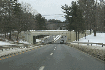
This 1998 photo shows the northbound William Floyd Parkway (Suffolk CR 46) at the Long Island Expressway (I-495) in Yaphank. (Photo by Steve Anderson.) |
||
|
The William Floyd Parkway (Suffolk CR 46), named after a signer of the Declaration of Independence from the Shirley-Mastic area, is a four-lane divided highway extending north from Smith Point Park on Fire Island to NY 25A in Shoreham. South of the Long Island Expressway (I-495) in Yaphank, CR 46 has many traffic lights, commensurate with rapid residential and commercial development. North of the Long Island Expressway, the William Floyd Parkway has most of the characteristics of a limited-access highway, with very few at-grade intersections and a cloverleaf interchange at NY 25 (Middle Country Road) in Ridge. |
||
|
Throughout the 1960's and 1970's, Suffolk County officials pushed for the idea of extending Interstate 91 from Connecticut across Long Island Sound to the William Floyd Parkway. North of I-495, CR 46 would have been easily upgraded to I-91 with minimal cost and displacement, since even today the area is sparsely populated. South of I-495, an extension of I-91 along the existing route of CR 46 to Fire Island would have been controversial in the more developed Shirley-Mastic area. |
||

|
The I-91 routing along the William Floyd Parkway may have been arranged through a swap between the SCDPW and the New York State Department of Transportation (NYSDOT). In 1970, the NYSDOT wanted to turn NY 25A into a four-lane divided highway along the North Shore. To address concerns of residents and businesses along 25A, former Suffolk County Executive H. Lee Dennison proposed handing over NY 25A to Suffolk County, which would preserve its many historic stretches. In return, the NYSDOT would have received William Floyd Parkway. This proposal, which was also advanced by the Nassau-Suffolk Regional Planning Board, was defeated by the Suffolk County Legislature. |
||
|
As for the Shoreham-New Haven Bridge, the southern anchorage would have used part of the property of the LILCO nuclear power plant (a $6 billion debacle that was constructed but never used, and mothballed in 1989). The northern anchorage of the bridge in the New Haven area would have been near the intersection of Interstates 95 and 91. While officials on Long Island pushed for the bridge, those in Connecticut were vehemently opposed. Furthermore, among the competing cross-Sound bridge proposals, the Shoreham-New Haven route was the longest (at 19.3 miles) and among the costliest. |
||
|
After defeat of the Oyster Bay-Rye Bridge proposal in 1973, the Shoreham-New Haven Bridge and the limited-access William Floyd Parkway received broad support among Suffolk County residents. Officials in Connecticut, however, remained vehemently opposed to a route, as evidenced by public hearings in 1979. By the 1980's, interest in the proposed bridge had waned. |
||
|
THE ROAD TO NEW HAVEN? This 1998 photo shows a nearly empty William Floyd Parkway (Suffolk CR 46) at the NY 25 (Middle Country Road) interchange in Ridge. One proposal given serious consideration during the 1970s would have extended I-91 across Long Island Sound from New Haven to Shoreham, raising the utilization of the highway. (Photo by Steve Anderson.) |
||

|
The William Floyd Parkway should be converted into a controlled-access freeway from Smith Point County Park to the proposed southern approach of the Shoreham-New Haven Bridge. As part of its conversion to I-91, the present roadway should be widened from four to six lanes between NY 27A-CR 80 and NY 25A, grade separations constructed, and service roads built where necessary to serve local traffic. The upgraded highway also would serve as a more effective coastal evacuation route than the current facility. |
||
|
The new exits on the upgraded William Floyd Expressway should be as follows: |
||

|
SOURCES: "Restoration and Protection of Fire Island," Long Island State Park Commission (1938); "Expressway Plans," Regional Plan Association News (May 1964); Transportation 1985: A Regional Plan, Tri-State Transportation Commission (1966); "Transportation: 1985 Highway Plan," Nassau-Suffolk Regional Planning Board (1970); A Comprehensive Transportation Study for Proposed Bridge Crossings, Creighton, Hamburg, Incorporated (1971); "A Bridge Link to Connecticut Could Spur Long Island's Economic Growth," Newsday (3/22/1978); Long Island Sound Bridge Study, New York State Department of Transportation (1979); "Lee Koppelman: The Master Planner" by Marilyn Goldstein, Newsday (8/08/1986); "A Drive for New, Wider Roads" by Mara Rose, Newsday (2/22/1990); "Long Island to Connecticut: Location and Placement of a High Speed Ferry Service," Report to the Suffolk County Legislature (1993); "Heat on the Highway: Skeptics Doubt Denial of Grand Plan To Widen 25A" by Sylvia Adcock, Newsday (3/03/1997); "Seeking Solutions to William Floyd Backup" by Barbara LaMonica, Suffolk Life (3/31/2004); Suffolk County Department of Public Works; Daniel T. Dey; Nick Klissas; Scott Oglesby; Jim Wade; Russ Weisenbacher. |
||

|
WILLIAM FLOYD PARKWAY LINKS: |
||

|
WILLIAM FLOYD PARKWAY NYSDOT / SUFFOLK COUNTY DPW CONTRACT ARCHIVES: |
||
|
WILLIAM FLOYD PARKWAY LINKS: |
||

|
|
||

|
Back to The Roads of Metro New York home page. |
||
|
Site contents © by Eastern Roads. This is not an official site run by a government agency. Recommendations provided on this site are strictly those of the author and contributors, not of any government or corporate entity. |
||