
|
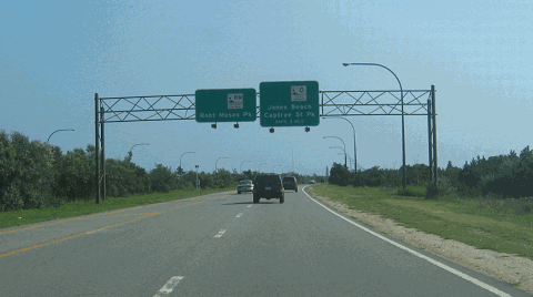
This 2007 photo shows the southbound Robert Moses Causeway approaching the un-numbered exits for Captree Island and the Ocean Parkway. (Photo by Steve Anderson.) |
||
|
PASSENGER CARS ONLY |
||
|
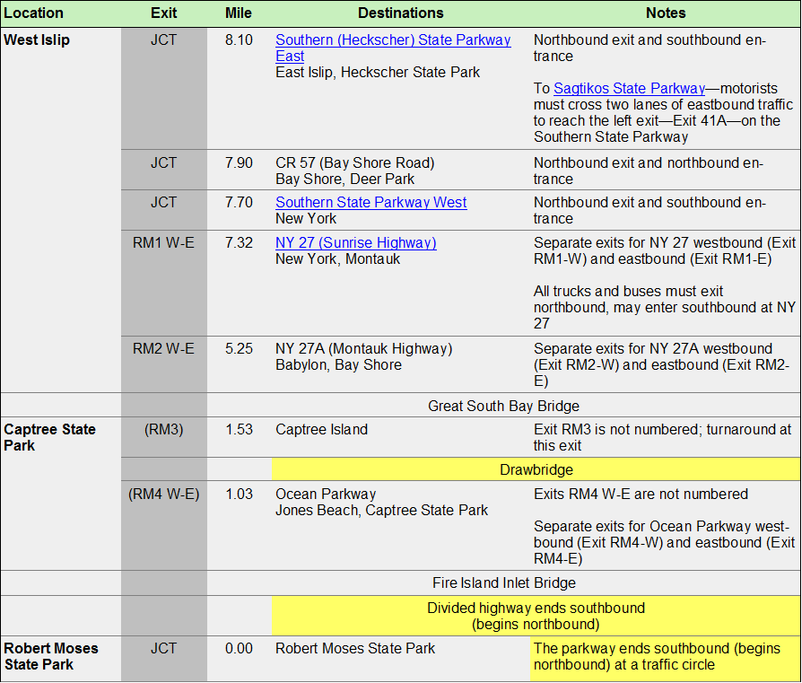
SOUTHBOUND: scroll down |
||
|
Site contents © by Eastern Roads. This is not an official site run by a government agency. |
||