
|
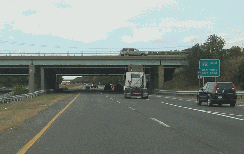
This 2007 photo shows the northbound Nicolls Road (Suffolk CR 97) at the exit for the Long Island Expressway (I-495) in Holtsville. (Photo by Steve Anderson.) |
||
|
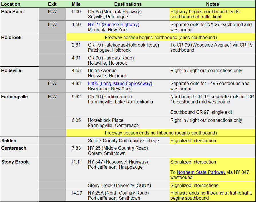
NORTHBOUND: scroll down |
||
|
Site contents © by Eastern Roads. This is not an official site run by a government agency. |
||