
|
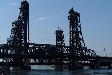
This 2001 photo shows the Wittpenn Bridge (NJ 7) across the Hackensack River. The NJDOT expects to replace the existing lift span with a modern drawbridge by 2011. (Photo by Charles Stanton.) |
||

|
LINKING THE PASSAIC VALLEY WITH JERSEY CITY: Opened in 1930, the Wittpenn Bridge, which was named after H. Otto Wittpenn (the mayor of Jersey City from 1908 to 1913), crosses the Hackensack River between Jersey City and Kearny. Part of NJ 7 (and originally multiplexed with NJ 10), the four-lane lift span also connects I-280 with the Holland Tunnel (I-78). |
||
|
Beginning just west of the Charlotte Circle (where NJ 7 intersects US 1 and US 9) in Jersey City, the 2,169-foot-long bridge crosses the Hackensack River at 35 feet over mean high water. When the 83-foot-long vertical-lift span is raised between the bridge's 140-foot-tall towers, a 100-foot clearance is provided for ships. The steel superstructure was constructed atop piers made of reinforced concrete. The roadway deck, which accommodates four 10-foot-wide lanes, was also constructed of reinforced concrete. |
||
|
Part of the comprehensive "Portway International Intermodal Corridor" project, the new $372 million Wittpenn Bridge is scheduled for completion in 2011. The Wittpenn Bridge replacement project has taken on greater importance in recent years because of an increase in fatal accidents along the existing bridge and its approaches. |
||

|
Type of bridge: |
||
|
Vertical lift |
||

|
SOURCES: "FAI 105 Interstate Highway Corridor: Recommendation Report," New Jersey State Highway Department (1957); Transportation 1985: A Regional Plan, Tri-State Transportation Commission (1966); "Parley Discusses Route 7 Crash Site Improvements" by Jeff Theodore, The Jersey Journal (10/13/2000); "Deadly Bridge" by Jonathan Miller, The Jersey City Reporter (10/15/2000); "Lower Route 7 Speed" by Jason Fink, The Jersey Journal (1/05/2001); Hudson Alliance for Rational Transportation; New Jersey Department of Transportation; Phil Case; Dan Moraseski; Charles Stanton. |
||

|
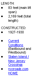
WITTPENN BRIDGE LINKS: |
||
|
WITTPENN BRIDGE CURRENT CONDITIONS: |
||

|
|
||
|
Back to The Crossings of Metro New York home page. |
||
|
Site contents © by Eastern Roads. This is not an official site run by a government agency. Recommendations provided on this site are strictly those of the author and contributors, not of any government or corporate entity. |
||