 |
|
|
|
|
|
|
|
|
|
|
|
|
|
|
|
|
|
|
|
|
|
|
|
|
|
|
|
|
|
|
|
|
|
|
|
|
|
|
|
|
|
|
|
|
|
|
|
|
|
|
|
|
|
|
|
|
|
|
|
|
|
|
|
|
|
|
|
|
|
|
|
|
|
|
|
|
|
|
|
|
 |
|
|
|
|
 |
|
 |
|
|
|
|
|
|
|
|
|
|
|
|
|
|
|
|
 |
|
|
|
|
|
|
|
 |
|
|
|
|
|
|
|
|
|
|
|
|
|
|
|
|
|
|
|
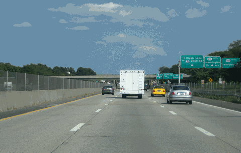
This 2014 photo shows the eastbound Sunrise Highway (NY 27) at EXIT 40 (NY 231 / Babylon-Northport Expressway and Suffolk CR 34 / Deer Park Avenue) in North Babylon. (Photo by Steve Anderson.)
|
|
|
|
|
|
|
|
|
 |
|
|
|
|
 |
|
|
|
|
|
|
|
|
|
49.7 miles (80.0 kilometers) controlled-access freeway length;
70.6 miles (113.6 kilometers) total length
1958-1998 (controlled-access sections)
|
|
|
|
|
|
|
|
|
 |
|
|
|
|
|
|
|
|
BEGINNING AS AN ARTERIAL HIGHWAY: The original Sunrise Highway was constructed as a four-to-six lane, at-grade arterial highway from southern Queens east to Massapequa, Nassau County in the 1920's. The highway, which carries the NY 27 designation, was extended to Great River, Suffolk County (in the area of Connetquot State Park) by 1940, and to Phyllis Drive in East Patchogue by 1953. As each section of Sunrise Highway was completed, the signs for NY 27 were transferred from Montauk Highway (which became NY 27A) to the new road. (Hard to believe, but Phyllis Drive, now just a residential side street, once carried the NY 27 designation from the 1953 eastern terminus of Sunrise Highway to Montauk Highway.)
THE NEED FOR A SOUTH SHORE EXPRESSWAY: Planning for a controlled-access Sunrise Highway began as early as 1936, when the Regional Plan Association (RPA) recommended construction of a South Shore expressway extending from Brooklyn east to Patchogue. The expressway, which unlike the parkways of the time was to be open to all vehicles, was to serve highly populated areas.
In 1949, the New York State Department of Public Works (NYSDPW) recommended the construction of a controlled-access highway that would be open to all traffic. Part of the state's 1,780-mile "interstate and interregional highway system," the proposed expressway was to extend from New York City east to Montauk Point. When the NYSDPW announced the proposal, new suburban developments were replacing duck farms along the south shore of Long Island. Less than a decade later, the state announced firm plans for a 50-mile-long, controlled-access Sunrise Highway from West Babylon to Southampton. In the 1960s, the route was proposed to extend further east to Amagansett.
The NYSDPW defined the route of the Sunrise Highway as follows:
Beginning at the Suffolk-Nassau county line at the terminus of state highway eight thousand four hundred seventy-four (NY 110) in or near the village of Amityville, thence running generally easterly through or near the village of Brightwaters, the hamlet of Bay Shore, the village of Patchogue, the hamlets of Moriches, Eastport, Hampton Bays, Tuckahoe ,and Hardscrabble to state highway nine thousand three hundred five (existing NY 27) in or near the hamlet of Promised Land.
Work began in 1958 on the initial limited-access segments, the first one from Phyllis Drive in East Patchogue to EXIT 61 (Suffolk CR 51) in Eastport, and the second one from EXIT 65 (NY 24) in Hampton Bays to the present terminus at Shinnecock Hills. These two segments, which were built on new rights-of-way, were opened in stages between 1960 and 1963. The initial construction included a 368.5-foot-long fixed plate-girder bridge over Shinnecock Canal that provides 90 feet of horizontal clearance and 35 feet of vertical clearance.
Challenges to the construction of the "Sunrise Expressway" soon followed. When the NYSDPW first presented the NY 27 expressway plans, land along the highway was being developed with shopping centers and gasoline stations. Conversion of Sunrise Highway from a four-lane, at-grade divided highway to a six-lane, limited-access highway flanked by service roads, which was scheduled for completion by 1964, would prove a longer, more arduous process. Further east, concerns were raised about building a four-lane, limited-access Sunrise Highway through the environmentally sensitive Pine Barrens between Eastport and Hampton Bays.
|
|
|
|
|
|
|
|
|
|
|
|
|
|
|
|
|
|
|
|
|
|
|
|
|
 |
|
|
|
|
|
|
|
|
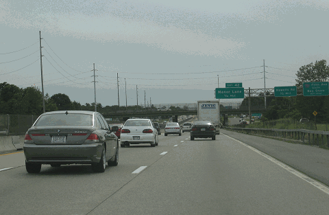
This 2004 photo shows the westbound Sunrise Highway at EXIT 43 (Suffolk CR 13 / Fifth Avenue) in Bay Shore. This section of Sunrise Highway was converted into an expressway with service roads in the early 1970s. (Photo by Steve Anderson.)
|
|
|
|
|
|
|
|
|
|
|
|
|
|
|
|
|
|
CONSTRUCTION TIMELINE: Following years of protracted budget battles, community hearings and relocations, reconstruction of the original Sunrise Highway, as well as the construction of the new section in the Town of Southampton, finally got off the ground. The Sunrise Highway project progressed in the following stages:
1967-1970: EXIT 37 (NY 109) in West Babylon to EXIT 40 (NY 231) in North Babylon
1970-1972: EXIT 40 to EXIT 44 (Brentwood Road) in Bay Shore
1970-1972: EXIT 61 (Suffolk CR 51) in Eastport to EXIT 65 (NY 24) in Hampton Bays
1981-1983: EXIT 44 to EXIT 46 (Suffolk CR 17, Southern State Parkway, Heckscher State Parkway and Connetquot Avenue) in Great River
1988-1992: EXIT 51 (Suffolk CR 97 and NY 454) in Bayport to EXIT 54 (Hospital Road) in East Patchogue
1994-1996: EXIT 49 (Suffolk CR 93) in Bohemia to EXIT 51
1995-1998: EXIT 46A (NY 27A and Suffolk CR 85) in Oakdale to EXIT 49
After nearly four decades of planning and construction, the final limited-access segment of Sunrise Highway was completed in May 1998. When the final controlled-access segment between Oakdale and Sayville opened, Jim Wade, Long Island contributor to NYCRoads.com, observed that there were already design faults:
What do you think about Sunrise Highway through Connetquot State Park because it has no service roads? The setup that reduces the highway from five lanes - three express and two service lanes - to three express lanes is not a good idea.
|
|
|
|
|
|
|
|
|
|
|
|
|
|
When the section from Brentwood Road (EXIT 44) to Connetquot Avenue (EXIT 46) was first done in the early 1980s, five eastbound lanes - three express and two service lanes - reduced to two lanes before stopping at a traffic light at the Montauk Highway crossover (currently EXIT 46A). The crossover at Montauk Highway allowed for legal U-turns. For about one-half mile, Sunrise Highway and Montauk Highway would merge their traffic onto a Sunrise Highway that only allowed for two lanes in each direction.
|
|
|
|
|
|
|
|
|
|
|
|
|
|
|
|
|
|
Then the express lanes and service roads along Sunrise Highway were constructed between NY 454 (Veterans Memorial Highway) and NY 112, the New York State Department of Transportation (NYSDOT) hastily constructed a third lane in each direction between Connetquot Avenue and NY 454. As part of this project, creating a new, separate Montauk Highway alongside Sunrise Highway eliminated the crossover at the Sunrise-Montauk merge in Oakdale. Access was only available to and from the eastbound Sunrise Highway. Westbound motorists on Sunrise Highway had to exit at EXIT 46 (Heckscher State Parkway SOUTH) for access to Montauk Highway. The confusion that followed this new pattern, as well as the elimination of the Pond Road intersection made this segment of Sunrise Highway among the most dangerous stretches of highway in New York State.
Today, the lack of adequate service roads through the "Oakdale merge" aggravates rush hour conditions. During the morning rush, westbound traffic on the Sunrise Highway is backed up from Connetquot State Park to the entrance for EXIT 46. During the afternoon rush, where traffic from the Southern State and Heckscher State Parkway enters the eastbound Sunrise Highway, the removal of an eastbound lane on the express roadway slow traffic east to EXIT 47.
|
|
|
|
|
|
|
|
|
|
|
|
|
|
|
 |
|
|
|
|
|
|
|
|
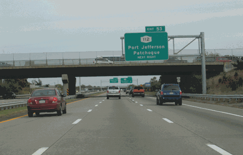
This 2007 photo shows the eastbound Sunrise Highway (NY 27) at EXIT 52A (Suffolk CR 83 / North Ocean Avenue) in Patchogue. This section of Sunrise Highway was rebuilt in the early 1990s. (Photo by Steve Anderson.)
|
|
|
|
|
|
|
|
|
|
|
|
|
|
|
|
|
|
THE POW-MIA MEMORIAL HIGHWAY: In 1997, the New York State Legislature designated the entire length of NY 27 in Queens, Nassau and Suffolk counties as the "POW-MIA Memorial Highway." From the New York State Senate archives:
Portion of the state highway system to be designated as the "POW-MIA Memorial Highway:" All that portion of the state highway system beginning in Queens county at its border with Kings county on the Belt Parkway and continuing east along the Southern (Belt) Parkway to the vicinity of Brookville Boulevard, and then on to the Sunrise Highway and thereafter continuing on Route 27 to its eastern terminus at Montauk Point in Suffolk county shall be designated as the "POW-MIA Memorial Highway."
KEEPING IT MOVING: In 1999, State Senator Owen Johnson (R-Babylon) and Assemblyman Robert Sweeney (D-Lindenhurst) introduced bills that would raise the speed limit on the Sunrise Highway to 65 MPH between EXIT 37 in West Babylon and its eastern terminus in Shinnecock Hills. Johnson and Sweeney found support among upstate legislators who wanted to revert to the pre-1973 law, which set the state maximum freeway speeds at 65 MPH and let the NYSDOT determine these speeds. However, downstate legislators, led by Assembly Speaker Silver (D-Manhattan), held that the State Legislature, not the NYSDOT, determine speeds on each route segment. Despite qualified support from the Long Island Association (LIA) and the Automobile Club of New York for the new 65 MPH limit, the legislation had been killed.
Before 1973, the speed limit on the limited-access sections of Sunrise Highway was 60 MPH in western Suffolk, and 65 MPH in eastern Suffolk.
|
|
|
|
|
|
|
|
|
|
|
|
|
|
|
 |
|
|
|
|
|
|
|
|
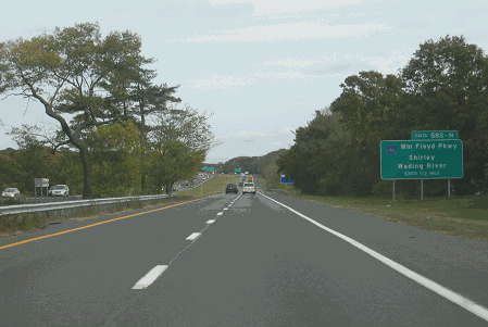
East of Patchogue, the Sunrise Highway narrows from six to four lanes. This 2007 photo was taken on the eastbound Sunrise Highway in Shirley, just west of EXIT 58 (Suffolk CR 46 / William Floyd Parkway). (Photo by Steve Anderson.)
|
|
|
|
|
|
|
|
|
|
|
|
|
|
|
|
|
|
RECENT IMPROVEMENTS: In 1999, a new eastbound exit ramp - EXIT 47 - was constructed for Pond Road South and businesses along the eastbound Sunrise Highway service road in Oakdale. During 2000 and 2001, the NYSDOT retrofitted the center median between EXIT 39 (NY 109) and EXIT 44 (Brentwood Road) with a four-foot-high, concrete "Jersey" barrier.
In the mid-2000s, NYSDOT rebuilt the Sunrise Highway bridges over East Moriches-Riverhead Road (Suffolk CR 51), as well as rehabilitated 10 other bridges from EXIT 61 (Suffolk CR 51) east to the Shinnecock Hills terminus. The project cost $11 million.
In 2015-2017, the NYSDOT replaced the overpasses at NY 110 in Amityville, Suffolk CR 47 (Great Neck Road) in Copiague, and Suffolk CR 3 (Wellwood Avenue) in Lindenhurst. Built in the early 1960s, the three bridges were among the first aluminum-beam overpasses to be constructed in this country, but showed signs of fatigue and aging. The overpass rebuilds, which cost $63 million, were part of a broader plan to improve safety on Sunrise Highway from the Nassau-Suffolk border to West Babylon, but no accommodations were made for the reconstruction of NY 27 as a controlled-access route in this area.
In 2022-2024, the NYSDOT replaced the original two-lane overpass at EXIT 54 (Hospital Road) in East Patchogue, which was built in 1959, with a five-lane overpass. The new $23 million overpass was built with turn lanes, wider shoulders, and wider sidewalks.
WHAT'S BEEN CONSIDERED: In recent years, the NYSDOT and the New York Metropolitan Transportation Council (NYMTC) have scheduled the following short-term and long-term projects along the Sunrise Highway:
|
|
|
|
|
|
|
|
|
|
|
|
According to studies sponsored by the NYSDOT in 2000, a fourth travel lane in each direction was considered from EXIT 45 (Heckscher State Parkway) east to EXIT 51 (Suffolk CR 97 / Nicolls Road). The two new lanes, which were to be set aside for HOV use during rush-hour periods, were expected to handle the new "Long Island Rapid Commute" (LIRC) vehicles envisioned by the "LITP 2000" plan. According to the NYSDOT, the LIRC articulated vehicles would travel on dedicated new and existing HOV lanes on controlled-access highways, as well as on existing arterial roads.
|
|
|
|
|
|
|
 |
|
|
|
|
|
|
|
|
|
|
The state's long-range plan also called for studies of a third travel lane in each direction on the mainline Sunrise Highway from EXIT 53 (NY 112) east to EXIT 58 (Suffolk CR 46 / William Floyd Parkway), as well as continuous service roads between EXIT 53 and EXIT 56 (CR 64 / Station Road). The NYSDOT has no current plans for construction of the third lane, though plans dating back to the 1950s show accommodations for future construction of both the third lane and service roads.
In the early-to-mid-2000s, the NYSDOT considered completing the gaps in the service roads between EXIT 53 (NY 112) and EXIT 56 (Suffolk CR 64 / Station Road). Construction of the service road project is expected to take place after 2005.
In 2019, the NYSDOT held public hearings for a proposed EXIT 58A (Barnes Road) in Moriches to close a 3.7-mile (6.0-kilometer) gap between EXIT 58 and EXIT 59 (Suffolk CR 25 / Wading River Road). The state shelved the project the following year amid strong opposition.
The Town of Southampton has recommended construction of a new interchange - EXIT 62A (Suffolk CR 88 / Speonk-Riverhead Road) - to serve the eastern campus of Suffolk County Community College. First proposed by the town in 2004 in its Eastport / Speonk / Remsenberg / Westhampton Area Study, the proposed exit is not included in current NYSDOT plans.
According to the NYSDOT, the controlled-access Sunrise Highway handles approximately 85,000 vehicles per day (AADT) from West Babylon through the Southern State / Heckscher State Parkway interchange, about 100,000 vehicles per day from the Southern State / Heckscher State Parkway interchange east to NY 112, about 75,000 vehicles per day from NY 112 east to Suffolk CR 46, and about 40,000 vehicles per day from Suffolk CR 46 east to the Shinnecock Hills terminus.
|
|
|
|
|
|
|
|
|
|
|
|
|
|
|
 |
|
|
|
|
|
|
|
|
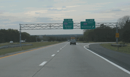
This 2007 photo shows the westbound Sunrise Highway (NY 27) at EXIT 64 (Suffolk CR 104 / Quogue-Riverhead Road) in Quogue. Photo by Steve Anderson.)
|
|
|
|
|
|
|
|
|
|
|
|
|
|
|
|
|
|
|
 |
|
|
|
 |
|
|
|
|
|
|
|
"You have got to put the cars someplace, and the road will have to be built somewhere, sometime." - William McElroy, chairman of the Sunrise Highway Extension Committee (1975)
THE SHINNECOCK SQUEEZE: At the eastern terminus of the controlled-access Sunrise Highway in Shinnecock Hills, two eastbound highway lanes combine with an eastbound lane from North Road (Suffolk CR 39) into a single eastbound lane for the combined NY 27-CR 39 east to Southampton. (The combined NY 27-CR 39 between Shinnecock Hills and Southampton is maintained by the Suffolk County Department of Public Works.) This "Shinnecock squeeze" creates long delays, particularly for Hamptons-bound traffic on summer weekends.
Since the late 1950s, officials from the NYSDPW (and later the NYSDOT) proposed an eastward extension of Sunrise Highway to Amagansett, approximately ten miles west of Montauk Point. The extension was proposed not only to alleviate the "Shinnecock squeeze," but also to accommodate future development along the South Fork.
The Tri-State Transportation Commission also recommended construction of the Sunrise Highway Extension as follows:
The Sunrise Highway Extension will bypass Southampton, Bridgehampton and East Hampton, relieving bottlenecks on nearby Montauk Highway. This proposal extends the expressway to serve eastern limits of development.
SUNRISE HIGHWAY THROUGH THE HAMPTONS? In 1969, the New York State Legislature approved a 23-mile extension of Sunrise Highway along the South Fork of Long Island, from Shinnecock Hills to Amagansett. The project was to cost $160 million, half of which was to have paid by the Federal government. The four-lane Sunrise Highway extension was to be built to Interstate-compatible standards, flanked by bicycle and equestrian trails. The eastbound and westbound roadways were to be separated by wide wooded medians. Between Shinnecock Hills and Southampton, the expressway would be flanked by service roads, which were to carry Suffolk CR 39.
To preserve the rural nature of the East End, entrance and exit points were to be kept to a minimum. The new exits for the Sunrise Highway extension were to be as follows:
EXIT 67: Suffolk CR 39 (County Road) and Suffolk CR 38 (North Sea Road)
EXIT 68: Suffolk CR 79 (Bridgehampton-Sag Harbor Road)
EXIT 69: NY 114 (East Hampton-Sag Harbor Turnpike)
EXIT 70: Suffolk CR 40 (Three Mile Harbor Road)
EXIT 71: Suffolk CR 45 (Amagansett-Springs Road)
EXIT 72: existing NY 27 (Montauk Highway)
Soon after public hearings began in earnest in 1970, it did not take long for the extension to generate controversy. Community leaders feared that the highway, which was to run along the Peconic Bay shore of the South Fork, would bring unwanted traffic and contamination of the underground water supply.
Environmental impact studies were conducted on the proposed route in 1973 and 1974. In these studies, the NYSDOT concluded that positive impacts - reduced congestion, lower pollution levels and preservation of rural character - along the Montauk Highway corridor would outweigh any negative impacts from the Sunrise Highway extension. In accordance with newly enacted environmental legislation, no rights-of-way had been purchased in advance of the proposed extension.
THE SOUTH FORK PARKWAY PROPOSAL: In response to fears of increased traffic, an alternative proposal was presented. The South Fork Parkway, which was to carry NY 27 traffic along the same right-of-way proposed for the Sunrise Highway extension, was also proposed as a limited-access facility. Unlike the Sunrise Highway extension, the South Fork Parkway was to be a "super 2" - a two-lane, controlled-access road with no median separation - with a design similar to that of the early state parkways built by Robert Moses.
THE FIGHT CONTINUES: When Perry Duryea, Jr., a Republican state assemblyman from East Hampton, obtained an initial $50 million in state and Federal funding, it appeared that construction would soon begin. However, the pro-Sunrise extension forces suffered a crushing setback when the U.S. Department of Transportation failed to approve the draft environmental impact statement. Finally, in 1975, Governor Hugh Carey canceled the Sunrise Highway extension, seeking instead alternatives that would "make the South Fork's recreational treasures more accessible to the public, but at the same time preserve the East End's environmental integrity."
Duryea later remarked on the defeat of the Sunrise Highway extension as follows:
They said if you build it they would come. They won and it wasn't built. They came anyway and now what do we have?
Proponents of a limited-access highway in the Hamptons refused to capitulate. In the years since Governor Carey voted down the original Sunrise proposal, the Hamptons grew into a world-class resort, and real estate values skyrocketed commensurately. Mounting traffic pressures on the East End pushed Carey to reverse his earlier decision in late 1981. This time, Carey supported construction of a two-lane ("super 2"), controlled-access highway along a 500-foot-wide right-of-way owned by the Long Island Lighting Company (now LIPA). The right-of-way also parallels the LIRR Montauk branch. The revised $74 million Sunrise Highway extension, which was scheduled for completion by 1990, was stalled throughout the 1980's by anti-highway forces.
By 1990, according to Long Island Regional Planning Board director Lee Koppelman, only two options existed to deal with the traffic. The first option was to simply widen existing two-lane roads, including Montauk Highway (NY 27), NY 114, and Suffolk CR 38, to four lanes. The second option was to construct a new limited-access highway along the Long Island Rail Road right-of-way to Amagansett.
The most likely setup for the highway would have been to construct separate two-lane roads on either side of the railroad tracks. Some years earlier, a similar plan to use the right-of-way but instead would rip out the tracks, was vociferously opposed by the LIRR, which carries thousands of people from New York City to the Hamptons every summer weekend.
The plan to use the LIRR right-of-way for the Sunrise Highway extension ran into other obstacles as well. The right-of-way goes through several existing communities, including Southampton, Bridgehampton and East Hampton. The railroad uses 29 at-grade crossings between Southampton and Amagansett. Grade separation of these crossing would have been required with the construction of a new limited-access highway, since the railroad would have been in the median of the highway. Furthermore, the railroad passes near several ponds and wetland areas. Before any highway could be constructed, lengthy environmental impact studies had to be undertaken.
Because of the lack of money and potential for community opposition, it appears unlikely that even the revised Sunrise Highway extension proposal along the LIRR right-of-way will ever be built. Even a more modest plan to widen CR 39 from two lanes to four lanes east of the current Sunrise Highway terminus met with intense opposition before it was eventually built between 2008 and 2013.
|
|
|
|
|
|
|
|
|
|
|
|
|
|
 |
|
|
|
|
|
|
|
|
This illustration from the draft environmental impact statement for the Sunrise Highway extension east to Amagansett shows the proposed roadway layout. One proposal had NY 27 relocated as a "super 2" roadway before the second carriageway was built at a later date.(Illustration credit: New York State Department of Transportation, via Tim W. Ferguson.)
|
|
|
|
|
|
|
|
|
 |
|
|
|
|
|
|
|
|
|
|
|
|
|
 |
|
|
|
|
|
|
|
A NEW EXPRESSWAY FOR NASSAU'S SOUTH SHORE: Specific proposals to convert Sunrise Highway between Queens and western Suffolk appeared as early as 1941 in the New York City master plan for express highways:
The conversion of Sunrise Highway (through Queens) from a major street to an express highway is recommended in order to complete the express highway system from Queens Boulevard to the city line. It is assumed the Sunrise Highway, east of the city line, will be converted to an express highway by the state.
One of the long-forgotten highway proposals in the New York City metropolitan area, the Atlantic Expressway was conceived in 1965 as "a vital link in a 21st-century interstate surface communications network enabling the more than 50 million people who will live in the Boston-to-Washington corridor a generation from now to move around the megalopolis." Planned as an eight-to-ten lane artery, the Atlantic Expressway would have followed the route of Sunrise Highway (NY 27) between Queens and the eastern end of Long Island.
The Tri-State Transportation Commission described the purpose and benefits of the Atlantic Expressway as follows:
The Atlantic Expressway, an east-west route through southern Nassau and Suffolk counties, will be an alternate route to the Long Island Expressway. Beginning at I-78 in Queens, the Atlantic Expressway will not only provide a through east-west route for commercial traffic on the south shore of Long Island, but also serve recreational areas.
DESIGN PLANS FOR THE ATLANTIC EXPRESSWAY: According to Triborough Bridge and Tunnel Authority plans unveiled in October 1966, the Atlantic Expressway was to be an eastern extension of the Cross Brooklyn Expressway, another road that was never built.
Between the Queens-Nassau border and the Seaford-Oyster Bay Expressway (NY 135) in Wantagh, the Atlantic Expressway was to be an eight-lane elevated highway. In some places, the expressway was to be on an elevated structure along the existing Sunrise Highway, and in other places, the expressway was to be constructed on elevated earth fill.
East of the Seaford-Oyster Bay Expressway, the design of the Atlantic Expressway provided for a four-lane, divided express highway for long-distance industrial and commercial traffic. This depressed, center roadway was to be flanked on either side by two- or three-lane (in each direction), limited-access roadways. The center and exterior roadways were to be separated by sloped and landscaped interior areas.
THE ATLANTIC EXPRESSWAY SPUR AND BRIDGE PLANS: A spur of the Atlantic Expressway was to split from Sunrise Highway at EXIT 55 (Suffolk CR 101 / Patchogue-Yaphank Road), where the spur was to follow the route of the current CR 101 to the Long Island Expressway (I-495). From Yaphank, an upgraded Long Island Expressway would continue east to points on the North Fork. A suspension bridge would then run from East Marion to just west of Old Saybrook, Connecticut. Finally, a 1.6-mile segment in Connecticut would have linked the bridge to the intersection of I-95 (Connecticut Turnpike) and the CT 9 Expressway.
COSTS AND OTHER CONCERNS: The bridge and its approach roads were scheduled to be completed in 1973 at a cost of $130 million. In its entirety, the Atlantic Expressway would have cost $333 million upon its scheduled completion in 1985. Originally, Rhode Island wanted to get in on the act as well, with a 24.6-mile crossing over a chain of islands from Orient Point east to Westerly, Rhode Island. However, this route was rejected because of its high costs (over $400 million in 1966 dollars) and low traffic projections.
A second spur, the Oakdale-Port Jefferson Expressway, was designed as an eight-lane express route (with a 2-2-2-2 configuration) to the proposed Port Jefferson-Bridgeport Bridge. The expressway spur would have cost an additional $90 million, and the bridge would have cost an additional $213 million.
The Atlantic Expressway complex was proposed as part of the Interstate highway system, in which the Federal government would have paid 90 percent of the cost. (However, its official Interstate designation was never given.)
Local opposition to the Atlantic Expressway was particularly fierce along the route in Queens and Nassau, where hundreds of homes and businesses would have been demolished. On March 19, 1966, the mayors of Valley Stream, Lynbrook, Rockville Centre, Freeport and Massapequa Park released the following statement:
The elevated and widened highway would have a devastating effect not only on business, but also on the whole life of our communities. The loss in real estate value, uprooting of business and partitioning our communities would be an incalculable blow to this entire South Shore area.
From Ralph Herman, contributor to NYCRoads.com and misc.transport.road:
I do remember the Cross Brooklyn Expressway-Atlantic Expressway scenario. I also remember that since Robert Moses was still TBTA head, it was taken very seriously by residents of Brooklyn, Ozone Park and Springfield Gardens. I was 13 years old at that time, but I was already a very serious "road geek." I had just moved from Hollis to Woodmere at the time, and I remember my focus was on how the Nassau Expressway and Clearview Expressway timetables would be changed.
Since the Atlantic Expressway corridor was proposed to follow the LIRR-Sunrise Highway corridor, there was great concern in the Nassau County villages along the LIRR Babylon Branch as to the possible destruction of their "downtowns" due to the proposed 10-to-12 lane Atlantic Expressway.
By the end of 1967, the NYSDOT abandoned plans for the Atlantic Expressway. Nevertheless, proponents of the expressway refused to give up. In 1970, the Nassau-Suffolk Regional Planning Board advocated its construction as follows:
In Nassau County, it is recommended that a limited-access, east-west highway be built through the southern (NY 27) corridor from the proposed Clearview Expressway Extension to the Sunrise Expressway in West Babylon. The purpose of this route would be to obtain east-west capacity in the corridor where it is needed. This route would help relieve the burden on the Long Island Expressway, the Northern State Parkway and the Southern State Parkway through Nassau and Suffolk counties. It will also reduce the demands placed on the north-south feeders that currently serve them.
EXIT NUMBERING ON SUNRISE HIGHWAY AND THE ATLANTIC EXPRESSWAY: Currently, the exit numbering scheme begins in West Babylon with EXIT 37 (NY 109). Lower exit numbers may have been reserved for the never-built sections of the limited-access Sunrise Highway through Nassau County, as well for the never-built Cross Brooklyn Expressway through southern Queens and Brooklyn. At the present time, the NYSDOT has no plans to continue the limited-access Sunrise Highway west of West Babylon.
|
|
|
|
|
|
|
|
|
|
|
|
|
|
 |
|
|
|
|
|
This sign posted on a fence at Hempstead Lake State Park in Rockville Centre. It read "Danger: Deep Water," but it was recycled from a former sign showing the boundary of the potential Atlantic Expressway right-of-way. The Villages of Rockville Centre and Lynbook were two jurisdictions which opposed the Atlantic Expressway. (Photo by John Giordano, Village Administrator, Village of Lynbrook.)
|
|
|
|
|
|
|
|
|
|
|
|
|
|
|
|
 |
|
|
|
|
|
The limited-access portion of Sunrise Highway should be extended west to Massapequa, using the 2-3-3-2 configuration used on the West Babylon-to-Patchogue segment. Four new exits should be built:
EXIT 33: NY 27A (Carmans Road) / Future Sunrise Mall redevelopment
EXITS 34 N-S: NY 110 (Broadway)
EXITS 35 N-S: Suffolk CR 47 (Great Neck Road)
EXITS 36 N-S: Suffolk CR 3 (Wellwood Avenue)
|
|
|
|
|
|
|
|
|
|
|
|
|
|
|
Lighting should be installed along the Sunrise Highway east to EXIT 53 (NY 112) in Patchogue. The speed limit should be raised from 55 MPH to 65 MPH along the entire controlled-access section from West Babylon to Shinnecock Hills.
|
|
|
|
|
|
|
 |
|
 |
|
|
|
|
|
|
|
|
|
|
|
|
|
|
In central Suffolk County, the Sunrise Highway should be widened to six lanes between EXIT 53 (NY 112) in Patchogue and EXIT 58 (Suffolk CR 46 / William Floyd Parkway) in Shirley. Interchanges in this area should be reconstructed to provide improved access, and continuous service roads should be provided.
In eastern Suffolk, the Sunrise Highway should be extended east from Shinnecock Hills to Amagansett as a four-lane, controlled-access freeway, following the NYSDOT plans of the early 1970s. Strict zoning should be enforced to protect the communities through which the "Sunrise Extension" is built, though admittedly, concerns about groundwater quality and community disruption are likely to stall this plan.
Daniel Timothy Dey, frequent contributor to NYCRoads.com, recommends reviving a controversial, limited-access Sunrise Highway between Rosedale, Queens and western Suffolk. Such a proposal would provide a viable limited-access alternative for commercial vehicles using the Long Island Expressway. His Nassau County exit list is as follows:
EXIT 18: Belt Parkway / NY 27 (Conduit Avenue)
EXIT 19: Hook Creek Boulevard
EXIT 20: Green Acres Mall
EXIT 21: Central Avenue / Rockaway Avenue
EXIT 22: Peninsula Boulevard / Hempstead Avenue
EXIT 23: Merrick Road
EXIT 24: Oceanside Road
EXIT 25: Grand Avenue / Milburn Avenue
EXIT 26: Main Street / Henry Street
EXITS 27 S/N: Meadowbrook State Parkway
EXIT 28: Merrick Avenue
EXIT 29: NY 106 (Newbridge Road)
EXITS 30 S/N: Wantagh State Parkway / TO Wantagh Avenue
EXITS 31 S/N: NY 135 (Seaford-Oyster Bay Expressway)
EXIT 32: NY 107 (Hicksville Road) / TO Bethpage State Parkway Extension
|
|
|
|
|
|
|
|
|
|
|
|
|
|
|
|
|
|
|
|
|
|
|
 |
|
|
|
|
|
SOURCES: "Freeways Are Now Urged," The New York Times (12/13/1936); "Master Plan: Express Highways, Parkways and Major Streets," New York City Planning Department (1941); Highway Needs in New York State, New York State Department of Public Works (1949); "Sunrise Highway Extension Being Pushed" by Byron Porterfield, The New York Times (6/13/1959); Regional Highways: Status Report, Tri-State Transportation Commission (1962); Arterial Progress 1959-1965, Triborough Bridge and Tunnel Authority (1965); "Feasibility Report: Long Island-New England Bridge and Connecting Highways," New York State Department of Public Works (1965); "Long Island-to-Connecticut Bridge and Highway Proposed," The New York Times (1/16/1966); "Nassau Villagers Fight Elevated Sunrise Highway" by Roy R. Silver, The New York Times (3/20/1966); "Cross Brooklyn Expressway Route Selection Study," Triborough Bridge and Tunnel Authority (October 1966); Transportation 1985: A Regional Plan, Tri-State Transportation Commission (1966); "Long Island Expressway Crosses Brookhaven," The Long Island Advance (10/19/1967); "Transportation: 1985 Highway Plan," Nassau-Suffolk Regional Planning Board (1970); "Sunrise Highway Extension: Route 27, Shinnecock Hills to Amagansett: Administrative Action Draft Environmental Impact Statement and Section 4(f) Statement," Federal Highway Administration and New York State Department of Transportation (1972); "Sunrise Highway: Route 27, Brentwood Road to Phyllis Drive: Administrative Action Final Environmental Impact Statement and Section 4(f) Statement," Federal Highway Administration and New York State Department of Transportation (1973); "NY Report on Sunrise Extension" by Bob Wacker, Newsday (10/22/1974); "Carey Blocks Sunrise Bypass, But Backers of Plan Still Have Hope" by Barbara Delatiner, The New York Times (3/31/1975); "Highway Plan Stirs Ire on South Fork" by Andrea Aurichio, The New York Times (12/13/1981); "Sunrise Highway Report: Route 27, Bay Shore to Patchogue: Administrative Action Final Environmental Impact Statement and Section 4(f) Statement," Federal Highway Administration and New York State Department of Transportation (1981); "Lee Koppelman: The Master Planner" by Marilyn Goldstein, Newsday (8/08/1986); "Planners' Legacy: Long Island's Ghost Highways" by William Bunch, Newsday (9/21/1986); "Traffic Remedies Eyed for Two Forks" by Mitchell Freedman, Newsday (2/22/1990); "LI's Roads in a Big Jam" by Tom Morris, Newsday (2/22/1990); "Lex: The Duryea Dynasty" by George Stankevich, The Independent (9/24/1997); "A Vision for Transportation," Town of Southampton (1997); "Commuters Get Express Road East" by Kara Blond, Newsday (5/12/1998); "Chasing Drivers" by Hugo Kugiya, Newsday (4/29/1999); "Highway Hopes That Faded" by Sidney C. Schaer, Newsday (11/05/1999); "DOT Announces Traffic Projects," Suffolk Life (5/30/2001); "Ask Dr. Conehead" by Kim Nava-Fiorio, Newsday (7/15/2001); "Hamptons Traffic and the Road Not Taken," TimWFerguson.com (6/21/2022); "Slow Road to Summer" by John Valenti, Newsday (5/28/2003); "Ask Dr. Conehead" by Kim Nava-Fiorio, Newsday (12/14/2003); "New York's 'Most Dangerous Road' To Be Widened?" by Carey London, The Independent (12/15/2004); "Eastport / Speonk / Remsenburg / Westhampton Area Study," Town of Southampton (2004); "DOT Halts Plan To Add Sunrise Highway Interchange at Barnes Road" by Carl Corry, GreaterLongIlsand.com (5/21/2020); "Hospital Road Bridge Nears Completion" by Nicole Fuentes, The Long Island Advance (10/18/2023); "County Road 39 Corridor Study," Suffolk County Department of Public Works (2024); New York Metropolitan Transportation Council; Daniel T. Dey; Ralph Herman; Douglas Kerr; Nick Klissas; Larry Lucchetti; Jim Wade.
NY 27 shield by Ralph Herman.
Lightpost by Millerbernd Manufacturing Company.
Speed limit and HOV signs by C.C. Slater.
|
|
|
|
|
|
|
|
|
|
|
|
|
|
|
|
 |
|
|
|
|
|
|
|
|
|
 |
|
|
|
|
|
|
|
|
|
 |
|
|
|
|
|
|
|
|
|
 |
|
|
|
|
|
|
|
|
 |
|
|
|
|
|
THE EXITS OF METRO NEW YORK:
Sunrise Highway exit list by Valerie Deane.
|
|
|
|
|
|
|
|
|
|
|
 |
|
|
|
|
|
|
|
|
|
|
|
|
Site contents © by Eastern Roads. This is not an official site run by a government agency. Recommendations provided on this site are strictly those of the author and contributors, not of any government or corporate entity.
|
|
|
|
|
|
|
|
|
|