"You're saying that NJ 440 in Bayonne is dead in the water, so to speak?" - Lyle Goldman
THE NORTHERN NJ 440 FREEWAY: Proposed in 1936 as a replacement for the existing NJ 1 (now part of the NJ 440 surface road), the northern section of the NJ 440 Freeway, also known unofficially as the Bayonne Freeway, was to provide an express route between the Jersey City-Hoboken area, the Holland Tunnel (I-78) and the Bayonne Bridge (NY 440). The 3.5-mile-long, four-lane Bayonne Freeway was to be constructed in a 200-foot-wide right-of-way on the western edge of Jersey City and Bayonne on fill in Newark Bay. Interchanges were to be constructed at the Bayonne Bridge, West 30th Street, the NJ 169 Connector (West 59th Street) and West 63rd Street.
Designed for a capacity of 27,000 vehicles per day (AADT), the NJ 440 Freeway was to be built exclusively for through traffic. It was to relieve local north-south roads on the east side of Bayonne that were already heavily burdened with traffic from the Constable Hook industrial area and a nearby military base. However, because it was to be constructed on the west side of Bayonne, the NJ 440 Freeway would not provide access for industrial traffic generated on the east side.
In 1966, the Tri-State Transportation Commission recommended the development of the NJ 440 route as an expressway as follows:
The NJ 440 Freeway will connect I-78 to the Bayonne Bridge, providing a direct route to western Staten Island from Manhattan. It will also improve access to the Narrows Bridge from Hudson County.
The cost of the northern section of the NJ 440 Freeway, which was estimated at $46 million in 1967, had skyrocketed to $133 million by 1976. A small, 0.5-mile-long section of the Bayonne Freeway between NJ 169 and West 63rd Street in Bayonne was constructed between 1968 and 1971.
By the mid-1970's, the NJ 440 Freeway had encountered significant public opposition. Some factors leading to the freeway's eventual demise were its potential adverse effects on the ecology of Newark Bay, infringement upon three parks in Bayonne, and restricted waterfront access.
In 1976, the NJ 440 Freeway proposal was offered in conjunction with an NJ 169 surface arterial along the east side of the Jersey City-Bayonne peninsula. Realizing the difficulties in completing the freeway, the New Jersey Department of Transportation (NJDOT) stated the following in its draft environmental impact statement that year:
Further work on this project has been postponed pending comprehensive study of providing alternative means of providing this north-south link between existing NJ 440 and the Bayonne Bridge.
Citing inadequate traffic volumes for both routes to be constructed, the NJDOT dropped the proposed northern section of the NJ 440 Freeway in 1977. However, the road appeared on maps as late as 1990. On June 30, 1999, Governor Christine Whitman signed Chapter 150 of the laws of 1999, which officially de-designated the Bayonne portion of NJ 440 by repealing the law that originally designated the route. The statement submitted with the bill by its sponsors (one of whom, Assemblyman Joseph Doria, is also mayor of Bayonne) declared the following:
This bill repeals P.L.1959, c.57 that designates State Highway Route 440 in the city of Bayonne. Plans to construct Route 440 in the city of Bayonne were abandoned quite some time ago. This bill would thus act to delete what is essentially an obsolete reference in New Jersey's statutory law and permit the area of the proposed route to be available for other purposes.
At the site of the northern terminus, a new park may be developed on the vacant land (classified as "North 40") adjacent to the existing Stephen Gregg Park.
THE NJ 169 SURFACE ARTERIAL: In 1959, the first 2.2-mile segment of NJ 169 between Prospect Avenue in Bayonne and Hudson CR 501 (John F. Kennedy Boulevard) in Jersey City opened to traffic. This route, which parallels the New Jersey Turnpike-Newark Bay Extension (I-78) for about one mile, varies from two to four lanes in width, and has both divided and undivided sections. It is a hybrid route, containing both signalized intersections and grade separations.
In 1971, the NJDOT proposed a four-lane surface arterial route between Jersey City and the Bayonne Bridge. The route, which was to be an extension of the existing NJ 169, was to serve traffic generated by industrial areas on the east side of the Jersey City-Bayonne peninsula. The $75 million NJ 169 extension was to have a design capacity of 37,000 vehicles per day (AADT).
Through most of its length, the NJ 169 surface arterial was to have four lanes for through traffic, and additional turn lanes where appropriate. It was to provide grade separation at Hudson CR 501 (John F. Kennedy Boulevard), Avenue C, Broadway, Linnet Street, 40th Street and 45th Street in Bayonne. The arterial was to have 12-foot-wide lanes, 10-foot-wide shoulders, variable medians, and a design speed of 45 MPH.
The 1971 proposal included a western extension of the existing NJ 169 to the new NJ 440 freeway "stub" along Newark Bay. This section of the "NJ 169 Connector" (West 59th Street) opened in 1975.
By the mid-1970's, the NJ 440 Freeway proposal had generated significant opposition from civic and environmental groups. Citing the need to develop different alternatives along this corridor, the newly formed Tri-State Regional Planning Commission recommended a study of the "Bayonne Corridor" in 1975. The Commission proposed that freeway, arterial route and transit alternatives be studied before improvements could be made.
In 1976, both the NJ 169 arterial and the NJ 440 Freeway were proposed in conjunction with the "Liberty Harbor Redevelopment Plan." Bowing to mounting opposition, the NJDOT dropped the NJ 440 Freeway along Newark Bay from state plans the following year.
Construction of the NJ 169 arterial began in the 1980's. The NJDOT minimized right-of-way costs by building on top of the abandoned roadbed of the Central Railroad of New Jersey. In 1992, the 3.1-mile-long, four-lane NJ 169 between the Bayonne Bridge and Prospect Avenue was opened to traffic.
FOR THE SIGNS THEY ARE A'CHANGING: In 2000, Jonathan Sachs, a New Jersey contributor to nycroads.com, presented the following case for re-designating the existing NJ 169 as NJ 440:
With the completion and realignment of Route 169 in Bayonne and Jersey City several years back, the road provides the missing link of Route 440 through Bayonne. If you look at the road by ignoring the posted route numbers, it is apparent that 169 and 440 are part of the same highway. So wouldn't it make a little bit of sense to re-designate NJ 169 as NJ 440 to eliminate the gap? I am amazed not only that this has not occurred, but also that this issue has not been brought before the public. The current designation of this road destroys the integrity of the entire New Jersey highway network. This discrepancy should be corrected by the NJDOT in the very near future.
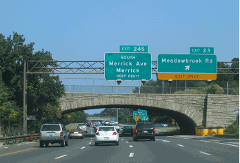
On May 14, 2001, the NJDOT officially replaced the existing NJ 169 markers with NJ 440 shields. The NJDOT also placed mileposts every half-mile along the new NJ 440. The recent efforts by the NJDOT seem to contradict the state's effort two years earlier to remove the NJ 440 designation through the city of Bayonne.
In this 2001 photo, NJDOT crews prepare to remove the NJ 169 shield from this sign gantry in Bayonne. The route of NJ 169 was re-designated NJ 440 on May 14, 2001. (Photo by Christopher G. Mason.)
SOURCES: "New Jersey Builds Better Highways," New Jersey State Highway Department (1961); Regional Highways: Status Report, Tri-State Transportation Commission (1962); "Expressway Plans," Regional Plan Association News (May 1964); Transportation 1985: A Regional Plan, Tri-State Transportation Commission (1966); New Jersey Highway Facts, New Jersey Department of Transportation (1967); "Route 169 and Route 440, Administrative Action Draft Environmental Impact Statement and Section 4(f) Statement," Federal Highway Administration and New Jersey Department of Transportation (1976); "Route 169 Land Service Road, Administrative Action Final Environmental Impact Statement and Section 4(f) Statement," Federal Highway Administration and New Jersey Department of Transportation (1977); "Route 169 Is Now Route 440" by Michaelangelo Conte, The Jersey Journal (5/17/2001); Mark Baber; Frank Curcio; Lyle Goldman; Joe Kuczynski; Raymond C. Martin; Dan Moraseski; Jonathan Sachs; William F. Yurasko.