 |
|
|
|
|
|
|
|
|
|
|
|
|
|
|
|
|
|
|
|
|
|
|
|
|
|
|
|
|
|
|
|
|
|
|
|
|
|
|
|
|
|
|
|
|
|
|
|
|
|
|
|
|
|
|
|
|
|
|
|
|
|
|
|
|
|
|
|
|
|
|
|
|
|
|
|
|
 |
|
|
|
|
 |
|
 |
|
|
|
|
|
|
|
|
|
|
|
|
|
|
|
|
 |
|
|
|
|
|
|
|
 |
|
|
|
|
|
|
|
|
|
|
|
|
|
|
|
|
|
|
|
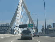
This 2007 photo shows the eastbound NJ 24 Freeway at EXIT 8 (Summit Avenue) in Summit. The next exit for Broad Street is now EXIT 9. (Photo by Steve Anderson.)
|
|
|
|
|
|
|
|
|
 |
|
|
|
|
 |
|
|
|
|
|
|
|
|
|
10.4 miles (16.8 kilometers)
1967-1992
|
|
|
|
|
|
|
|
|
|
|
|
|
|
 |
|
|
|
|
|
THE HISTORY OF ROUTE 24: Route 24 through New Jersey, now a collection of state- and county-maintained roads between Easton, Pennsylvania and Newark, was a major stagecoach route in the eighteenth century. Colonial travelers would take a leisurely three days to travel the 60-mile route on stagecoach. On the first day, riders would begin in Easton and end the day's travel at Schooley's Mountain, just east of Hackettstown. The second day's journey would begin down the mountain to Long Valley, traverse Chester and Mendham, and end at Morristown. Stagecoach travelers would arrive in Newark on the third day.
|
|
|
|
|
|
|
|
|
|
|
|
|
|
|
|
|
|
|
|
|
Under optimal weather and traffic conditions, traveling the entire original route today would take approximately an hour and a half. However, Chris Blaney, New Jersey contributor to nycroads.com, described the signing inconsistencies that can make the Route 24 journey longer:
Phillipsburg to Hackettstown: NJ 57
Hackettstown to Long Valley: Morris CR 517
Long Valley to Chester: Morris CR 513
Chester to Morristown: Morris CR 510
Morristown to Newark: NJ 124
Beyond the western terminus of the freeway in Morristown, the existing NJ 24 was poorly signed west to Hackettstown. The New Jersey State Highway Department (and later the New Jersey Department of Transportation, or NJDOT) neither maintained NJ 24, nor erected NJ 24 shields, west of Morristown. However, according to Blaney, the state gave the road a route designation - it was originally called Route S-24 - to make it part of a numbered highway network. With the NJ 24 Freeway now completed, and the NJ 124 land-service road having its origin at the Morristown Green, the NJDOT removed the NJ 24 shields west of Morristown.
A NEW EXPRESSWAY FOR UNION AND MORRIS COUNTIES: Planning for a realignment of NJ 24 began as early as 1950. At that time, the existing NJ 24 (now NJ 124) between Springfield and Morristown was a two-to-four lane surface route, serving as "Morris-Essex Turnpike" and "Main Street" through several congested downtown areas. Curbside parking conditions, numerous traffic signals, substandard lane widths and heavy traffic volumes adversely affected traffic safety and capacity on the existing route. In 1952, the proposed NJ 24 realignment was designated as a freeway by the New Jersey state legislature.
By constructing the NJ 24 Freeway, state highway officials sought to not only relieve congestion on existing NJ 24 (now NJ 124), but also meet anticipated traffic demands on the Springfield-to-Morristown corridor. With the planning and development of the Interstate highway system in the mid-1950s, the NJ 24 Freeway was to serve as an important link in the regional highway plan.
|
|
|
|
|
|
|
|
|
|
|
|
Route location studies for the NJ 24 Freeway began in 1959. In these studies, the state highway department planned the route to extend from I-78 (Phillipsburg-Newark Expressway) in Springfield to I-287 (Middlesex Freeway) in Morristown, two Interstates also in the design stage at the time. Upon the conclusion of these studies, public hearings were held along the proposed route in the late spring of 1960. In August 1960, the Bureau of Public Roads (which later became the Federal Highway Administration, or FHWA) approved the NJ 24 Freeway alignment.
|
|
|
|
|
|
|
|
|
|
|
|
|
|
|
|
|
|
|
|
|
|
|
|
|
The six-lane freeway from I-78 west to John F. Kennedy Parkway and NJ 124 in Chatham was designed for a capacity of 50,000 vehicles per day (AADT). West of Chatham, the four-lane freeway between John F. Kennedy Parkway and I-287 in Morristown was designed for a capacity of 30,000 vehicles per day (AADT).
The 10.6-mile-long NJ 24 Freeway, which was estimated to cost $80.5 million, was included in the 1962 state construction program. Although it was scheduled for completion in 1965, the freeway would not be finished for three decades.
|
|
|
|
|
|
|
|
|
|
|
|
I-278 ALONG ROUTE 24? Some maps published by the Triborough Bridge and Tunnel Authority (TBTA) placed the I-278 designation along the NJ 24 Freeway west to I-287 in Morristown. In 1970, the state of New Jersey submitted a proposal to extend I-278 along NJ 24 to Morristown, in the hope of getting 90 percent Federal funds to finish the freeway.
|
|
|
|
|
|
|
 |
|
 |
|
|
|
|
|
|
|
|
|
|
The Federal Highway Administration (FHWA) rejected the proposal. If it had been approved, the I-278 designation would have continued for one mile on the I-78 local lanes between the current EXIT 49 (where I-278 was to join I-78) and EXIT 48 (the NJ 24 Freeway alignment).
|
|
|
|
|
|
|
|
|
 |
|
|
|
|
|
 |
|
|
|
|
|
|
|
|
|
|
|
This 2007 photo shows the eastbound NJ 24 Freeway at EXIT 2 (Morris CR 510 / Columbia Turnpike) in Florham Park. After three decades of delays, this four-lane section opened in 1992. (Photo by Steve Anderson.)
|
|
|
|
|
|
|
|
|
|
|
|
|
|
|
|
|
|
|
|
SPRINGFIELD TO CHATHAM: Right-of-way acquisition for the NJ 24 Freeway began in late 1960, and continued throughout the 1960's. Construction began on the 3.5-mile, six-lane section in Union County in 1967. By 1972, this section from the Chatham-Short Hills area to I-78 was completed. Several years later, with the completion of I-78 through Essex County, an express route was ready to connect with Newark and New York City.
|
|
|
|
|
|
|
|
|
|
|
|
|
|
Service roads were constructed to connect to local streets along the route of the NJ 24 Freeway between I-78 and John F. Kennedy Parkway. These service roads were designated NJ 124. In the Summit-Short Hills area, where the NJ 24 Freeway is depressed, the NJ 124 service roads parallel above each side of the freeway. Local streets cross the depressed freeway and connect the service roads.
In the early 1970s, construction proceeded on a 3.5-mile, four-lane section from John F. Kennedy Parkway west to Brooklake Road in Chatham. This section includes an incomplete interchange with Triborough Road (or Eisenhower Parkway Extension-Morris CR 609). Since this section did not connect to any road, it remained useless for years after it was completed.
Posting in misc.transport.road, Chris Blaney described one interesting facet about this section:
If you have ever been on the NJ 24 Freeway about a mile west of EXIT 7A, there is a 1970's-era overhead gantry and faded exit sign. All of the button copy was peeled off the sign but you can still tell what the faded letters were when the sign was made (EXIT 12-Triborough Rd-Chatham-Livingston). This is an abandoned overpass, quite wide, which would have been a new road in Chatham, connecting NJ 124 with Eisenhower Parkway in Livingston. Only this bridge and a few hundred feet of road on both ends were ever built. Why EXIT 12 and not EXIT 6? This was numbered because the NJ 24 Freeway was scheduled to continue for another six miles west of I-287 into Mendham.
According to the NJDOT, approximately 80,000 vehicles travel on this six-lane section of the NJ 24 Freeway each day.
CHATHAM TO MORRISTOWN: Design and construction of the remaining 3.5-mile, four-lane section of the NJ 24 Freeway between Brooklake Road and I-287 in Morris County had been subject to follow, but was delayed for two decades by budgetary and environmental pressures. In July 1973, the FHWA issued a statement informing the NJDOT that, since a substantial amount of time had elapsed since the 1960 public hearings, and since this section of the NJ 24 Freeway had not yet received design approval, new location studies and an environmental impact statement (as required on all new Federally funded projects since 1970) had to be processed.
Public hearings on the proposed route proceeded between 1977 and 1981, at which route alternatives and their potential environmental impacts were presented. The selected alternative for the NJ 24 Freeway featured measures to mitigate environmental effects, such as limited interchange access and the use of natural and artificial sound barriers. These changes were proposed amid concerns from Madison, Chatham and Florham Park that new interchanges would bring more traffic and pollution to their towns.
The proposed NJ 24 Freeway extension featured a "Chatham Connector," which was to be a southern extension of Eisenhower Parkway from Morris CR 510 (South Orange Avenue) in Livingston to NJ 124 (Main Street) in Chatham via the incomplete Triborough Road interchange. The proposed freeway extension also featured a "Madison Connector" that would have connected the freeway to NJ 124 near Drew University in Madison.
Work on the remaining section of the NJ 24 Freeway to I-287 began in 1988 after an agreement was reached between state and federal highway officials to permit construction through wetlands, in exchange for saving 78 acres of wetlands elsewhere in the state. Upon completion of the NJ 24 Freeway in November 1992, the existing NJ 24 (Main Street) west to Morristown was designated NJ 124. The Chatham and Madison connectors to the NJ 24 Freeway were never constructed.
According to the NJDOT, approximately 70,000 vehicles travel on this four-lane section of the NJ 24 Freeway each day.
CURRENT AND FUTURE IMPROVEMENTS: The NJDOT and other agencies have built and planned the following projects along the NJ 24 Freeway in recent years:
In 2000, the NJDOT re-signed and re-striped the lanes at the western terminus of the NJ 24 Freeway at I-287. The NJDOT took the advice of an engineer from a Denville engineer who suggested that the westbound terminus of NJ 24 be re-striped to provide separate exit-only lanes for EXIT 1A (Morris CR 511 / Whippany Road), as well as for the I-287 northbound and southbound exits.
The NJDOT widened the existing one-lane ramp from southbound I-287 to the eastbound NJ 24 Freeway to two lanes. The $4.0 million project, which required widening the NJ 24 overpass over I-287, was finished in December 2003.
The NJDOT plans to refill and surface NJ 24 from the I-287 terminus east to EXIT 7 (NJ 124). The $13 million project is expected to continue through 2007.
New residential and commercial development in the Madison-Florham Park area has led to discussions about providing additional interchanges along the NJ 24 Freeway between EXIT 2 (Morris CR 510) and EXIT 7 (NJ 124). Options discussed include some possible use of the Triborough Road overpass (at the unfinished EXIT 6) to extend to Eisenhower Parkway in Livingston, as well as a direct exit to the new business campus on the former Exxon headquarters site. Neither the NJDOT nor the towns along the route have reached a decision on any proposed interchanges.
In December 2001, the NJDOT raised the speed limit to 65 MPH along the entire length of the NJ 24 Freeway, except in the area of the I-78 interchange in Springfield.
|
|
|
|
|
|
|
|
|
|
|
|
|
|
 |
|
|
|
|
|
YESTERDAY AND TODAY�
LEFT: This circa late 1970s photo shows the signs erected for the Triborough Road interchange at least 15 years before the NJ 24 Freeway was built through the area. Note that the interchange was signed as EXIT 12, not as EXIT 6, which implied a planned western terminus of the NJ 24 Freeway west of Morristown. (Historical photo supplied by Josy Conklin.)
RIGHT: This 2007 photo shows the eastbound NJ 24 Freeway at the unfinished EXIT 6 (Eisenhower Parkway) in Chatham. Although an overpass was constructed to carry Eisenhower Parkway in the 1970s (nearly two decades before the NJ 24 Freeway was completed), there are no active plans to extend the parkway. The overhead sign along the westbound lanes has since been removed. (Photo by Steve Anderson.)
|
|
|
|
|
|
|
|
|
|
 |
|
|
|
|
|
|
|
|
|
|
|
|
|
|
|
|
|
|
 |
|
|
|
 |
|
|
|
|
|
|
|
In 1962, the Tri-State Transportation Commission recommended the construction of a 60-mile-long NJ 24 Freeway between I-78 in Springfield and US 22 in Phillipsburg. The four-to-six lane freeway was designed to supplement I-78, which was to also run between these two locations. It was to also relieve traffic on the US 22 and NJ 24 (NJ 57) corridors to western New Jersey and Pennsylvania.
A decade later, the NJDOT shortened the NJ 24 Freeway extension west of I-287 from 49.4 miles to 18.4 miles, by moving the western terminus of the route from I-78 in Philipsburg (near the New Jersey-Pennsylvania border) to US 206 near Chester, Morris County. In its report Master Plan for Transportation, the NJDOT described the route as follows:
The NJ 24 Freeway will be extended west of I-287 to US 206, providing a high-speed, east-west facility to the ever-expanding western limits of urban expansion in northeast New Jersey. NJ 24 does not currently exist west of Morristown, and traffic now traveling this corridor must utilize a two-lane county road that has poor vertical and horizontal alignment.
The NJDOT estimated the cost of the 18.4-mile-long extension of the NJ 24 Freeway at $74 million. The plan also called for the construction of a new spur freeway (NJ 178) that was to connect to I-80 along the NJ 53 corridor. (The NJ 178 Freeway was to split off to the north from NJ 24 near Hanover Avenue in Morris Plains, while the NJ 24 Freeway was to continue west along the Whippany River.)
In 1982, the NJDOT temporarily shelved the NJ 24 Freeway extension west of I-287. However, it said the following about the plan in its environmental impact statement:
The NJDOT does not currently plan to extend the Route 24 Freeway beyond I-287. The FHWA agreed that I-287 is a logical terminus for the freeway at this time. However, further expansion west of I-287 is not precluded from future study.
Talk of expanding the NJ 24 Freeway west from Morristown to Mendham Township resurfaced in the early 1990s with the completion of the Chatham-to-Morristown section. Officials from Morris Township and Mendham Township protested the freeway extension, which remained on state plans. In response, the NJDOT permanently shelved the western extension to Mendham Township in 1993.
Even after this cancellation, some residents express desire for a bypass of existing NJ 24 (actually maintained as CR 510, CR 513 and CR 517) through western Morris County. Arthur Malkin, North Jersey contributor to nycroads.com and misc.transport.road, presents his thoughts on the western extension of the NJ 24 Freeway:
My view is that a Route 24 bypass around Morristown could be helpful. Right now, if you are coming west on the Route 24 Freeway, and want to continue beyond Morristown, you have to go through town and around the green. However, wherever the freeway ends, whether in Mendham or Chester, the freeway would dump a lot of traffic onto the old two-lane Route 24. They are both charming towns, and they do not want that.
At the western terminus of the NJ 24 Freeway with I-287, there is no evidence (such as ghost ramps or roadway stubs) hinting at a future westward extension of the freeway.
|
|
|
|
|
|
|
|
|
|
|
|
|
|
 |
|
|
|
|
|
To accommodate future development in the area, the Chatham-to-Morristown section of the NJ 24 Freeway should be expanded from four to six lanes.
Continuing west of I-287, the NJ 24 Freeway should be constructed as a "greenway" that would have the following design attributes:
|
|
|
|
|
|
|
|
|
|
|
|
|
|
The greenway would be built within a 100-foot-wide footprint that would accommodate four 12-foot-wide lanes, 10-foot-wide right shoulders, four-foot-wide left shoulders, and a concrete ("Jersey") barrier to separate traffic flows. (This relatively narrow footprint compares with the 300-foot to 400-foot right-of-way width for a conventional freeway.)
The 60 MPH design speed, five percent grades and 1,115-foot curve radii will be somewhat less than conventional freeway design standards (70 MPH design speed, four percent grades and 1,850-foot curve radii), but permit fully controlled access.
New interchanges would be constructed for the NJ 24 Freeway Extension at US 206, Morris CR 513 (North Road), Morris Turnpike (Mendham-Mount Freedom) and US 202.
Some of the NJ 24 right-of-way, which would range in width from 150 feet to 300 feet (some of which already exists west of I-287), would be used for multi-use trails and wildlife preserves.
Despite such mitigation measures, such an extension would certainly face significant opposition. Furthermore, the high cost of land acquisition may deter the NJDOT from pursuing this proposal.
|
|
|
|
|
|
|
|
|
|
|
|
In the past, a re-designation of NJ 24 as I-178 had been mentioned in the misc.transport.road newsgroup. However, this re-designation appears unlikely to happen. Jim Carl, the roadway systems section chief at the NJDOT, responded to an e-mail sent by Arthur Malkin as follows:
|
|
|
|
|
|
|
 |
|
|
|
|
|
|
|
|
|
|
New Jersey does not have two "disconnected" NJ 24 routes. NJ 24 (a freeway as you point out) runs from I-287 to I-78 for a total length of 10.59 miles. When this route was completed, all other pieces of the former NJ 24 were renumbered to NJ 124 or dropped. As you mentioned, a historic NJ 24 traversed east-west across the state. This alignment is now split between CR 510 and CR 513. There are a couple of erroneous NJ 24 symbols on New Jersey's Tourist Map that may confuse citizens. These will be removed.
With respect to re-numbering NJ 24 to I-178, the Interstate System was designated by Congress, which imposed a limitation on the amount of mileage nationwide. Our completion of I-287 and Boston's Central Artery were the last Interstate projects to be completed. From a national perspective, designating NJ 24 as an Interstate route would be redundant since it is a parallel facility to I-280 and basically serving the same region. For these reasons, the NJDOT would not be compelled to renumber NJ 24.
|
|
|
|
|
|
|
|
|
 |
|
|
|
|
|
|
|
|
|
|
|
|
|
 |
|
|
|
|
|
SOURCES: Regional Highways: Status Report, Tri-State Transportation Commission (1962); Arterial Progress 1959-1965, Triborough Bridge and Tunnel Authority (1965); Transportation 1985: A Regional Plan, Tri-State Transportation Commission (1966); New Jersey Highway Facts, New Jersey Department of Transportation (1967); "Report on the Status of the Federal-Aid Highway Program," Committee on Public Works, U.S. Senate (1970); Master Plan for Transportation, New Jersey Department of Transportation (1972); "Route 24 Freeway, Administrative Action Final Environmental Impact Statement and Section 4(f) Statement," Federal Highway Administration and New Jersey Department of Transportation (1982); "Four-Lane Route 24 Opens Amid Hoopla" by John Cichowski, The Bergen Record (11/18/1992); "Route 24: Even the Name's an Adventure" by Lawrence Ragonese, The Star-Ledger (3/25/2001); "DiFrancesco Backs Plan To Expand 65 MPH Speed Limit," The Associated Press (8/15/2001); North Jersey Transportation Planning Authority; Chris Blaney; Frank Curcio; George Kowal; Arthur Malkin; Raymond C. Martin; Christopher G. Mason; Joseph Morano; Dan Moraseski; Scott Oglesby; William F. Yurasko.
NJ 24, I-278, and I-178 shields by Ralph Herman.
Lightposts by Millerbernd Manufacturing Company.
|
|
|
|
|
|
|
|
|
|
|
|
|
|
|
|
|
|
|
|
|
|
|
|
|
|
|
|
|
|
|
|
|
|
|
 |
|
|
|
|
|
|
|
|
 |
|
|
|
|
|
THE EXITS OF METRO NEW YORK:
NJ 24 Freeway exit list by Steve Anderson.
|
|
|
|
|
|
|
|
|
|
|
 |
|
|
|
|
|
|
|
|
|
|
|
|
Site contents © by Eastern Roads. This is not an official site run by a government agency. Recommendations provided on this site are strictly those of the author and contributors, not of any government or corporate entity.
|
|
|
|
|
|
|
|
|
|