


|
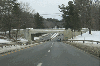
This 2000 photo shows the western terminus of I-587 (Colonel Chandler Drive) approaching the Thruway traffic circle, just west of downtown Kingston. (Photo by Steve Anderson.) |
||
|
MOST OBSCURE INTERSTATE? Driving along the New York State Thruway (I-87) in the vicinity of EXIT 19 in Kingston, one will find signs for NY 28. However, there are no signs for an Interstate highway, Colonel Chandler Drive, which connects the Thruway with the former capital of New York State. |
||
|
Although the four-lane connector, which is dually signed with NY 28, is constructed to Interstate standards along its entire 1.4-mile length, it does not have any interchanges. At its western terminus, I-587 ends at a traffic circle (just west the Kingston city limit at Esopus Creek), intersecting with the Thruway toll plaza approach to the north, NY 28 to the west, and Washington Avenue Extension to the south. The only overpass on the route is for Ulster CR 31 (Sawkill Road). At its eastern terminus, I-587 ends at a traffic light with NY 32 (Albany Avenue) in downtown Kingston. |
||


|
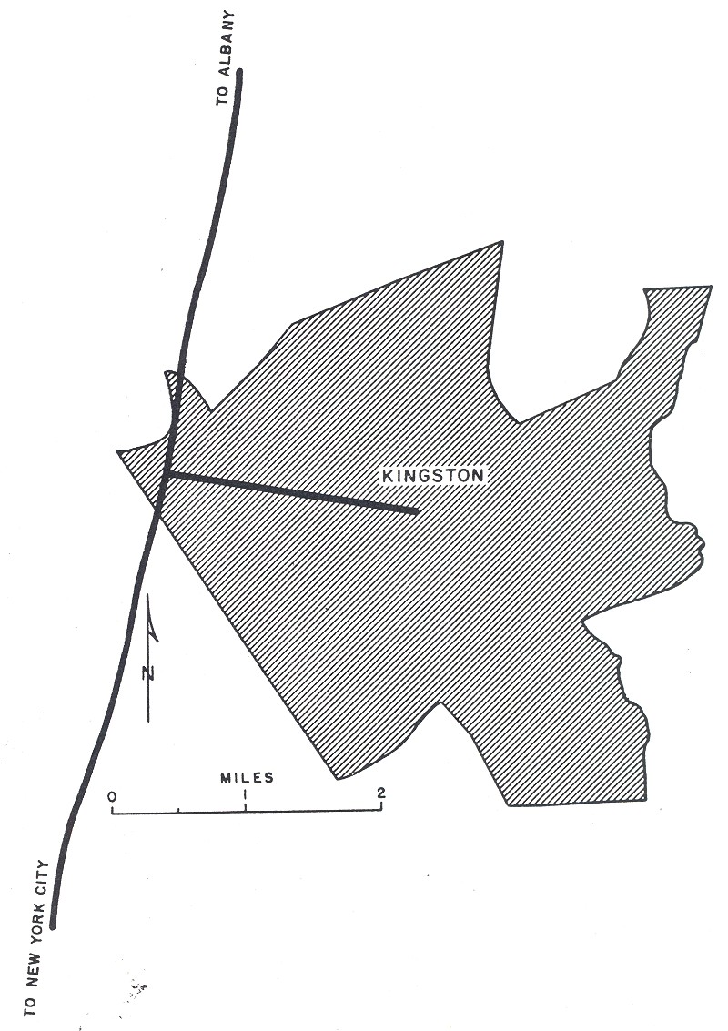
LEFT: This Terraserver image shows the entire length of Colonel Chandler Drive (I-587 and NY 28), from the northwest at the Thruway traffic circle to the southeast in downtown Kingston. (Terraserver image supplied by Nathan W. Perry.) RIGHT: This map shows the connection between I-587 and NY 28 (Colonel Chandler Drive), I-87 (New York State Thruway) and US 209 (Catskill Expressway). (Map by C.C. Slater.) |
||
|
I-587 should be extended west to the NY 28 / US 209 interchange, a distance of three-quarters of a mile. In addition, the existing traffic circle should be replaced with a "trumpet" interchange. Finally, I-587 shields should be added to signs along the New York State Thruway mainline. |
||
|
SOURCES: "Rockefeller Pledges Support for Highway," The New York Times (10/30/1958); New York State Department of Transportation; Marc Fannin; David J. Greenberger; Chris Helms; Ralph Herman; Michael G. Koerner; Mike Moroney; Scott Oglesby; Nathan W. Perry; C.C. Slater; J.P. Wing. |
||


|
COLONEL CHANDLER DRIVE LINKS: |
||
|
COLONEL CHANDLER DRIVE VIDEO LINK: |
||
|
COLONEL CHANDLER DRIVE CURRENT CONDITIONS: |
||

|
OFF-SITE EXIT LISTINGS: |
||
|
VIEW OR SUBMIT YOUR RATING TO RATETHEROADS.COM: |
||

|
Back to The Roads of Metro New York home page. |
||
|
Site contents © by Eastern Roads. This is not an official site run by a government agency. Recommendations provided on this site are strictly those of the author and contributors, not of any government or corporate entity. |
||