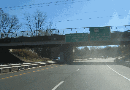
This 2006 photo shows the southbound CT 17 Expressway approaching the left exit for New London Turnpike in Glastonbury. (Photo by Steve Anderson.)
ALONG THE EAST BANK OF THE CONNECTICUT RIVER: Beginning in 1945, and over the next quarter century, the Connecticut Highway Department conducted studies on an expressway between Glastonbury and East Hartford, which is comprised of the CT 17 and CT 2 corridors. Construction of the CT 17 and CT 2 expressways began in 1949.
The CT 17 Expressway encompasses the following two "stub" sections:
NORTHERN SECTION: The 2.4-mile-long northern section, part of the original "Glastonbury Expressway," connects the CT 2 Expressway with Main Street (old Route 17) in Glastonbury. It opened in 1952 as a four-lane freeway from the CT 2 Expressway south to Hubbard Street, and as a two-lane "super 2" south to Main Street. Originally proposed as a four-lane boulevard, the expressway was constructed with overpasses after local residents raised safety concerns. One of these overpasses, the Hubbard Street overpass, was the first of pre-stressed concrete design in Connecticut. In the 1970's, the original "super 2" section in Glastonbury was widened to a standard four-lane freeway design.
SOUTHERN SECTION: About ten miles to the south, the 0.6-mile southern section, part of Achenson Drive, connects the CT 9 Expressway with Main Street in Middletown. Completed in 1957, this section of the CT 17 Expressway opened as a four-lane "stub" freeway as part of the CT 9 Expressway project through Middletown.
According to the Connecticut Department of Transportation (ConnDOT), the northern stub of the CT 17 Expressway carries approximately 15,000 vehicles per day (AADT), while the southern stub carries approximately 10,000 vehicles per day.
COMPLETING THE MISSING LINK: In its 1953 statewide development plan, the Connecticut Highway Department proposed the CT 17 Expressway as a 10-mile-long route connecting Glastonbury with Middletown. Nearly a decade later, state officials joined with the Tri-State Transportation Commission in recommending a 7.5-mile-long, four-lane extension of the CT 17 Expressway south to the CT 66 (US 6A) Expressway in Portland. The southern terminus was to be near the Arrigoni Bridge, providing connections to CT 17 and the CT 9 Expressway across the Connecticut River in Middletown.
In the late 1960's, the Connecticut Highway Department listed the CT 17 Expressway extension as part of its "future needs" program for completion after 1975. Included in this proposal was to be a 5.0-mile, $50 million reconstruction of CT 66 over the Connecticut River.
Further south, the Connecticut Highway Department recommended studies for a proposed CT 17 Expressway extension from Middletown south to Durham. The South Central Connecticut Planning Region went further, recommending construction of a freeway along the CT 17-CT 22-CT 100 corridor from Middletown south to I-95 (Connecticut Turnpike) in the East Haven-Branford area.
By the mid-1970's, ConnDOT had killed plans for completing the CT 17 Expressway.
SOURCES: Regional Highways: Status Report, Tri-State Transportation Commission (1962); Connecticut Highway Needs, Connecticut Highway Department (1967); Planning for the Future, Connecticut Highway Department (1968); "Route 17 Planning Study," Mid-State Regional Planning Agency (1999); Scott Oglesby; Alexander Svirsky.
CT 17 shield by Barry L. Camp. Lightpost by Millerbernd Manufacturing Company.