THE ORIGINAL LONG BEACH BRIDGE: Opened to traffic on June 18, 1922, the original Long Beach Bridge provided access from the city of Long Beach, which is located on a barrier island off Long Island, to the community of Island Park. The original span, which provided four 10-foot-wide lanes of traffic (two lanes in each direction) over Reynolds Channel, provided the first fixed link between the barrier island and Long Island.
In the years that followed, the Long Beach Bridge contributed to the growth of the city of Long Beach. Unlike the original Atlantic Beach Bridge (which opened in 1927) and the Loop Parkway (which opened in 1934), the Long Beach Bridge was a free crossing.
By the late 1940's, the inadequacies of the existing span were becoming apparent. The wider vehicles of the era reduced the number of traffic lanes from four to three, and lane control was administered by police officers according to the flow of vehicles. Furthermore, the original span only had a fixed clearance of 18 feet above mean high water, a situation that required 2,000 bridge openings per year. These conditions, along with the postwar suburbanization of Long Island, created bottleneck conditions on both sides of the span.
THE NEW LONG BEACH BRIDGE: Discussions for a new Long Beach Bridge were underway by the early 1950's. In July 1953, Nassau County Executive A. Holly Patterson awarded a $5 million construction contract to Merritt-Chapman and Scott Corporation of New York. The designing engineer was J.E. Greiner of Baltimore. All construction work was done under the supervision of the Nassau County Department of Public Works (NCDPW).
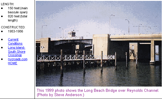
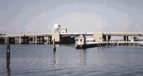
The new Long Beach Bridge consists of two parallel bascule spans, each carrying three 12-foot-wide lanes, as well as sidewalks for pedestrians and cyclists. Each 150-foot-long bascule drawbridge was constructed with an above-water clearance of 29 feet, a design that was estimated to reduce the number of bridge openings from 2,000 to 200 per year. Including approaches, each span measures 820 feet.
The east span, which carries three lanes of northbound traffic over Reynolds Channel, opened to traffic on May 19, 1955. Fourteen months later, the west span, which carries three lanes of southbound traffic across the channel, opened to traffic.
Between 1958 and 1973, the Long Beach Bridge was listed as a posted route on the Nassau County Route System as CR 1. Although there is no longer a route numbering system in the county, the bridge remains part of the county road system.
In the summer of 2002, the New York State Department of Transportation (NYSDOT) and the NCDPW began a $16 million project to rebuild the bridge. The project, which included rehabilitating the superstructure, abutments and seawall (including seismic retrofit); upgrading electrical and mechanical systems; and rebuilding the approaches, was completed in 2004. Lanes were closed on the bridge during reconstruction, and Reynolds Channel was closed to navigation during the nighttime hours.
This 1999 photo shows a wide-angle view of the Long Beach Bridge. Connecting the city of Long Beach with the community of Island Park, the twin bascule bridges were constructed between 1953 and 1956. The state and county rehabilitated the twin bridges between 2002 and 2004. (Photos by Steve Anderson.)
Type of bridge: Construction started: Opened to traffic (first span): Opened to traffic (second span): Length of each bascule draw span: Total length of each bridge: Width of each bridge: Number of traffic lanes: Width of roadway: Clearance at center above mean high water: Cost of original structure (including approaches):
Steel-deck bascule drawbridge August 13, 1953 May 19, 1955 July 25, 1956 150 feet 820 feet 45 feet 6 lanes 36 feet 29 feet $5,000,000
SOURCES: "Long Beach Span Planned," The New York Times (3/26/1952); "Twin Span To Ease Long Beach Traffic," The New York Times (8/13/1953); "Second New Bridge to Long Beach Opens at Island Park," The New York Times (7/21/1956); "Finally, A Needed Facelift for Long Beach Bridge" by John Valenti, Newsday (3/24/2002); New York Metropolitan Transportation Council; New York State Department of Transportation; Daniel T. Dey; Ralph Herman.
Nassau CR 1 shield by Ralph Herman. Lightpost by Millerbernd Manufacturing Company.